Category Archive: GIS Consortium

Apr 18

Droning on and on…Are drones destined for the trash?

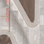
No, drone technology is not going away. In fact, its use in the professional services marketplace is only expanding. One application we’ve developed expertise in is utilizing UAS to analyze landfills. Landfills are often run as a business, and, like any business, operators make decisions based on metrics and try to increase efficiencies to improve …

Continue reading »

Sep 04

Ayres Spatially Integrated Video System

Ayres Spatially Integrated Video  (SIV) system provides a low-cost solution for recording and gathering street level information. We have developed this application to support a wide range of municipal and highway applications, including pavement/road condition analysis, pre-construction documentation, and asset/infrastructure inventory. Recent advancements in our approach have enabled us to simultaneously capture geo-referenced videos from multiple angles resulting …

Continue reading »

Jan 28

Rapid Tree Canopy Delineation from Aerial LiDAR

Recent developments in mapping technology have made it possible to efficiently extract two dimensional tree canopy polygons from LiDAR point clouds, even in leaf-off conditions. Historically, LiDAR data has been utilized primarily to create high resolution ground surfaces and digital contours. Digital Elevation Models and Digital Surface Models are the most common products derived from …

Continue reading »

Sep 01

Remote Sensing to ID Ash Trees in Urban Forest near Chicago, Illinois

Multispectral Imagery, Aerial LiDAR, and Ground Truthing Provide a Full Picture of an Urban Canopy By Jason Krueger, Ayres Associates; Jason Carlson, Applied Ecological Services; and Dr. Fugui Wang, Applied Ecological Services The greater Chicago region has been deeply affected by the Emerald Ash Borer (EAB) – an invasive species that has done considerable damage …

Continue reading »

Jun 08

Illinois GIS Consortium: Value through Collaboration

An invitation to municipalities in the greater Chicago area to participate in this high accuracy aerial mapping program. With the completion of the 2015 GIS Consortium (GISC) flights and with production in full-swing, communities are already preparing their mapping budgets for 2016 and beyond. GIS Consortium Members The GIS Consortium (GISC) is a group of local …

Continue reading »

May 24

Semi-automated Building Extraction from Aerial Imagery

A combination of traditional photogrammetric techniques and new software applications can now be used for semi-automated building extraction from high-resolution aerial imagery. This process enables a cost-effective alternative to manual building footprint compilation. Ayres Associates has developed workflows that support the creation of both simple 2D footprints and complex 3D buildings tailored to meet project …

Continue reading »

Apr 23

Another Successful Aerial Imagery & LiDAR Flight Season for GIS Consortium

Ayres Associates wrapped up another year of aerial imagery and LiDAR missions for the Illinois GIS Consortium.  This marks 15 consecutive years of aerial mapping missions for these Chicago area communities.   Digital Aerial Imagery Approximately 90 square miles of high resolution aerial imagery was acquired this spring using an UltraCAM Eagle digital imaging system. The …

Continue reading »

Mar 13

GIS Consortium featured in Spring issue of TRENDS

The GIS Consortium and the Village of Tinley Park, Illinois are featured in the current issue of TRENDS. “Supportive solutions: GIS Consortium provides cutting-edge data to impacted communities” By Bob Brown Read the article here:  http://www.ayresassociates.com/wp-content/ayres_images/GIS-Spring15.pdf       The Illinois-based GIS Consortium (GISC) is a group of 29 communities in the Chicago region that …

Continue reading »

Mar 08

3D Mapping: Valuable By-product of LiDAR

3D Feature extraction from LiDAR can provide municipalities with fresh perspectives on urban planning and help secure broad project support. The traditional view of LiDAR as a tool to produce topographic contours for floodplain studies is being challenged by increasingly complex applications for feature extraction from this technology.  Today, instead of merely looking at the …

Continue reading »

Oct 10

Tracking Impact of Emerald Ash Borer from Aerial Imagery

Ayres Associates is providing specialized infrared aerial imagery and LiDAR tools for urban tree canopy analysis in the Chicago area. Municipalities are taking extraordinary measures to deal with the impacts of the Emerald Ash Borer on urban forests. Aerial imagery may provide a useful tool for detecting dead and dying trees and for tracking the decline in the tree …

Continue reading »

Aug 31

3D Urban Modeling in the Chicago Suburbs

Advancements in Lidar processing tools and techniques are enabling new 3D modeling possibilities for GIS. Ayres Associates acquired high density Lidar of Tinley Park, Illinois in the spring of 2014.  The primary objective of the project was the development of 1-ft interval contours and a bare earth surface model for stormwater management applications.  However, there is …

Continue reading »

May 28

Tree Canopy Mapping from LiDAR in Chicago Region

Urban Tree Canopy Mapping in Tinley Park, IL. Ayres Associates derived tree crown and centroid data in the Village of Tinley Park using fixed-wing aerial LiDAR acquired at ~ 20 points per square meter. Individual tree crowns and centroids were prepared in shapefile format along with a rasterized Canopy Height Model (CHM). These vectorized features are attributed with calculated statistics …

Continue reading »

Apr 29

GIS Consortium Utilizes the New UltraCAM Falcon in 2014

The GIS Consortium (GISC) successfully wraps up another spring aerial imagery mission. Approximately 130 square miles of high resolution aerial imagery was acquired for the Consortium in 2014 using Microsoft’s new UltraCAM Falcon. The imagery will ultimately support a wide range of municipal applications including engineering, planning and zoning, and public safety.   We are …

Continue reading »

Apr 20

Municipal Geospatial Partnerships

Geospatial data such as topographic mapping, aerial imagery, and planimetrics create the digital foundation for any engineering project.  If you manage floodplains and storm water your first priority should be obtaining accurate up to date topographic data.  Flooding is not the only application that benefits greatly from geospatial data.  The potential applications for quality geospatial …

Continue reading »

Mar 28

The GIS Consortium – a role model for municipal cooperation

The Illinois-based GIS Consortium (GISC) is a group of 23 communities in the Chicago region that work together to develop GIS solutions to support a wide range of applications including municipal engineering, planning, forestry, and public safety.     Ayres Associates has been providing high-accuracy mapping and surveying services to member communities since the 1980s. …

Continue reading »

Older posts «