Semi-automated Building Extraction from Aerial Imagery
A combination of traditional photogrammetric techniques and new software applications can now be used for semi-automated building extraction from high-resolution aerial imagery. This process enables a cost-effective alternative to manual building footprint compilation. Ayres Associates has developed workflows that support the creation of both simple 2D footprints and complex 3D buildings tailored to meet project needs and budget constraints.
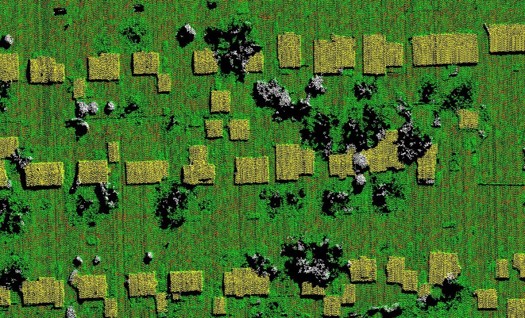
Image Correlation
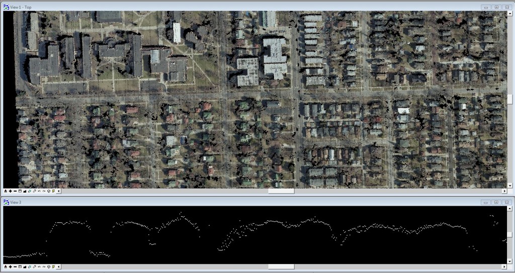
The task of extracting buildings from high-resolution aerial imagery begins with a point cloud derived from stereo-imagery. This point cloud is generated through a process called Image Correlation, also known as Photo-Correlated Digital Surface Modeling, or Semi-Global Matching (SGM). The overall procedure of extracting building from the image-correlated point cloud uses a combination of traditional photogrammetric mapping principles and software designed for LiDAR processing.
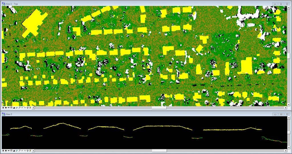
Image correlation is not exactly a new process: Ayres Associates has been using auto-correlation processes to build orthoimagery surfaces for 15 years. As aerial imagery programs are trending toward higher resolution, and with the introduction of new software, such as Intergraph’s Semi-Global Matching (SGM), we are now capable of generating point clouds with much greater definition and higher accuracy. Through this methodology we are generating millions of points per stereo-model which are then edited in the same fashion as LiDAR. These point clouds are efficiently processed in software systems built for managing large LiDAR data sets, including the TerraSolid suite.
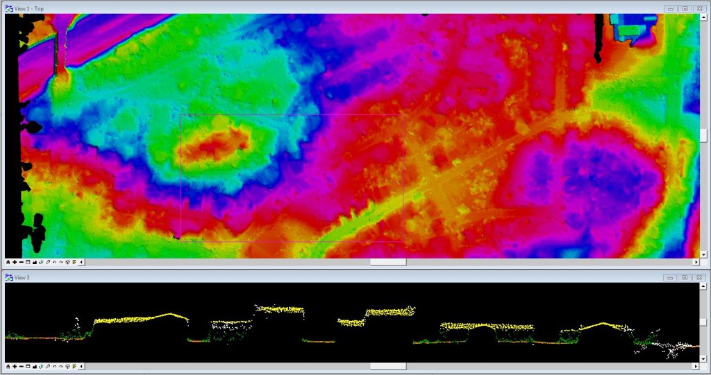
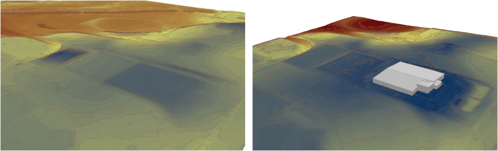
Colorized Point Cloud
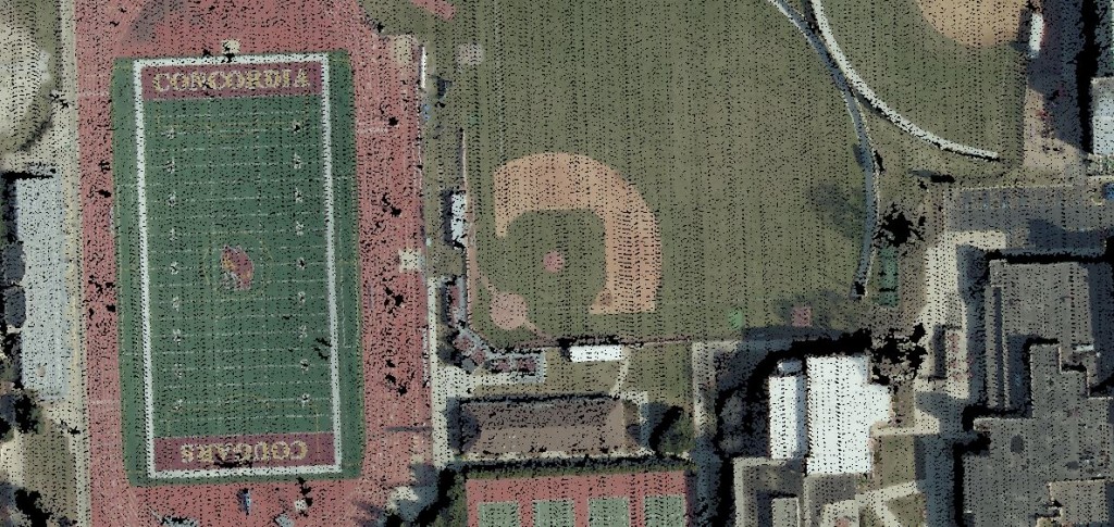
One unique advantage to using image correlated point clouds is the incorporation of RGB (and/or IR) values. The point cloud can be attributed with pixel values extracted from the aerial imagery- resulting is something that looks like a 3D photograph. This provides our specialists with an additional element for interpreting point clouds during the editing and classification process.
Feature Extraction
Building extraction occurs after image point cloud processing and editing is completed. Feature extraction software with edge detection and modeling tools will generate vector polygons from the classified imagery point cloud. Our specialists write customized macros to account for project specifics to better inform the software and define outputs. Additionally, the software permits some degree of customization based on the project landcover, such as urban vs rural environments.
The modeling software is capable of generating 2D building footprints and 3D complex rooflines. These can then be formatted to CAD based platforms or incorporated into a GIS world. Ayres has generated 3D buildings that have been ingested into Google Earth and Esri geodatabases.
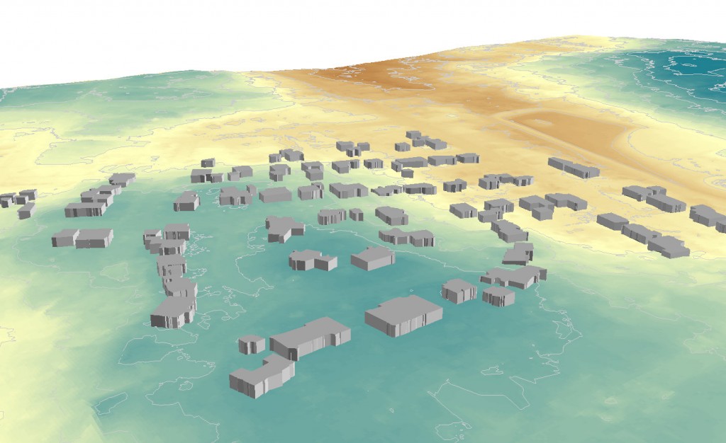
2D Buildings
The image below shows 2D building extracted from 6” aerial imagery of Sun Prairie, WI.
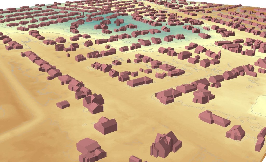
Extruded Buildings
The image below shows 2D building extracted from 6” aerial imagery and extruded to maximum building elevation.
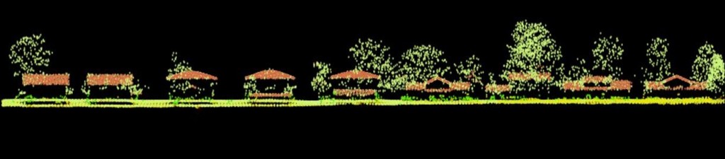
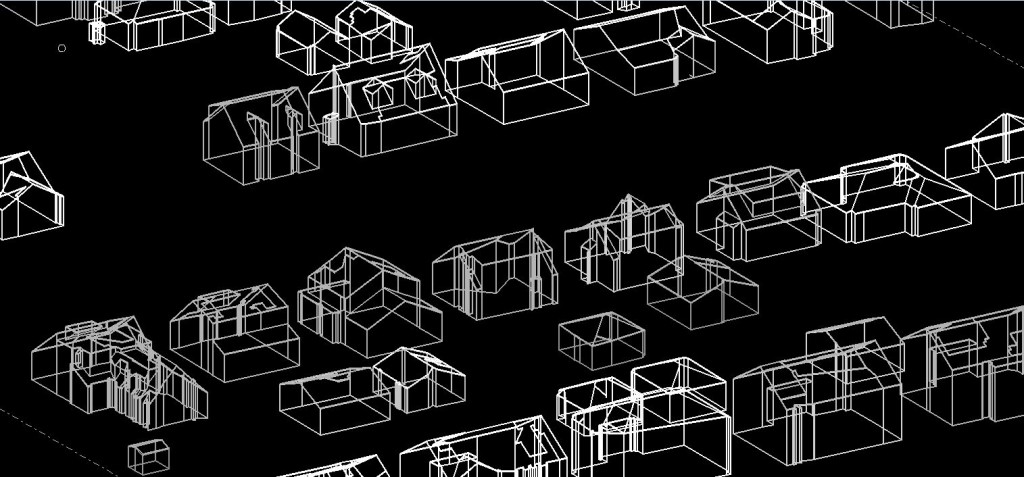
3D Buildings
The image below shows 3D building extracted from 3” aerial imagery of Sun Prairie, WI.
3D Buildings to Google Earth
The image below shows 3D building imported into Google Earth. 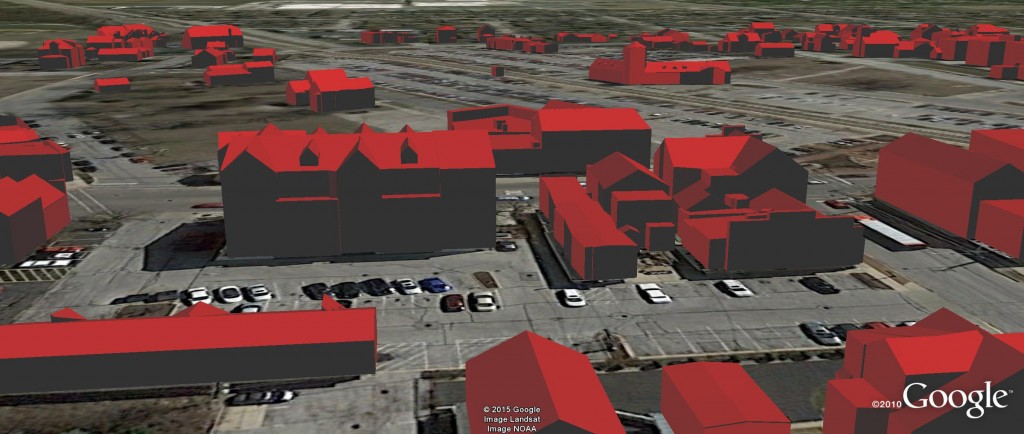
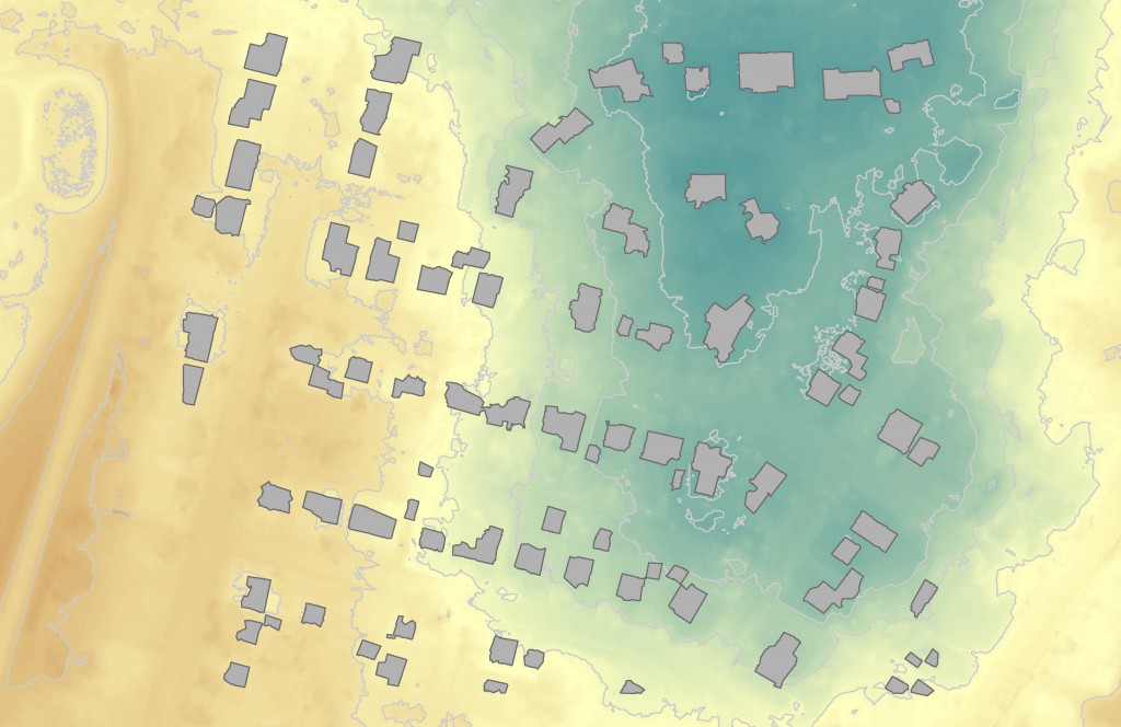
Capabilities and Limiting Factors
The software’s ability to automatically model buildings relies on several key elements of the input data. For example, the characteristics of the flight planning and image acquisition play a big role in the building output. These factors includes the camera system used, the native image resolution (ground sample distance), flight line overlap (sidelap), and frame overlap (forward lap). In some instances we are now planning imagery missions to better facilitate feature extraction.
Other limiting factors associated with landcover types can influence the automation process- especially tree canopy coverage. The automated extraction works best in areas with minimal overhanging trees. Generally, urban and agricultural environments are conducive to better automation.
Results from the automated process are not perfect, nor should they be deemed as accurate as those compiled by traditional, manual photogrammetric compilation. Manual edit at various stages throughout the process can introduce significant improvements to the end product. It is important to note that the degree of manual edit can be scaled according to project and budget needs.
Change Detection and Leveraging Existing Imagery
This approach may encourage more frequent updates of base mapping information to measure and document change in landscape. Since many of our clients have multiple imagery datasets going back over a decade, more opportunities for change detection analysis exist. Rapidly evolving hardware and software applications like this will enable new perspectives on semi-automated feature extraction and the role of 3D modeling in everyday GIS applications.


Recent Comments