

High Density Aerial Lidar of Wray, Colorado
(CDOT Front Range NPS – Region 4 – Riverine Design & Analysis)
 Ayres expands upon its use of high accuracy Lidar for important transportation corridor design and improvement projects throughout Colorado. In the past year, our Aerial Mapping Services group has been working closely with our engineering staff in our Fort Collins office to support a diverse team of professionals.
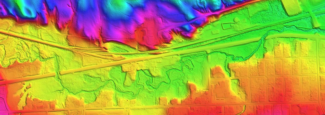
As an example of how geospatial data is employed, Ayres is managing the floodplain permitting and support of the hydraulic design for two US-34 bridges over the North Fork of the Republican River in Wray, Colorado. This project is being performed under a master contract for Riverine Design and Analysis for Region 4 of the Colorado Department of Transportation.

100-year model showing flow vectors and water surface color contours
 The flow at the bridges and through the town includes multiple split flow reaches and complex hydraulics as well as more than a half-dozen bridges beyond the primary two bridges of concern. Ayres is developing a 2-dimensional SRH model and 1-dimensional HEC-RAS model for the entire reach including the bridges and the town.High density Lidar and high resolution orthoimagery was collected for the entire project area in late summer 2017. This data is being used for the hydraulic modeling and also by the CDOT roadway and bridge design teams for the two bridges and the roadway interfaces. The Lidar was acquired at a density of
  8-points per square meter to support a surface model that achieves vertical accuracy of 0.3-ft, or greater. The resultant surface achieved 0.1-ft, at the 95% confidence level.
Aerial imagery was acquired simultaneously with the Lidar acquisition and was delivered as 3-inch resolution. The paired sensors provided two distinct advantages for this effort: a) lower flight cost, and b) capture environmental conditions that are consistent between the imagery and the Lidar.


Recent Comments