

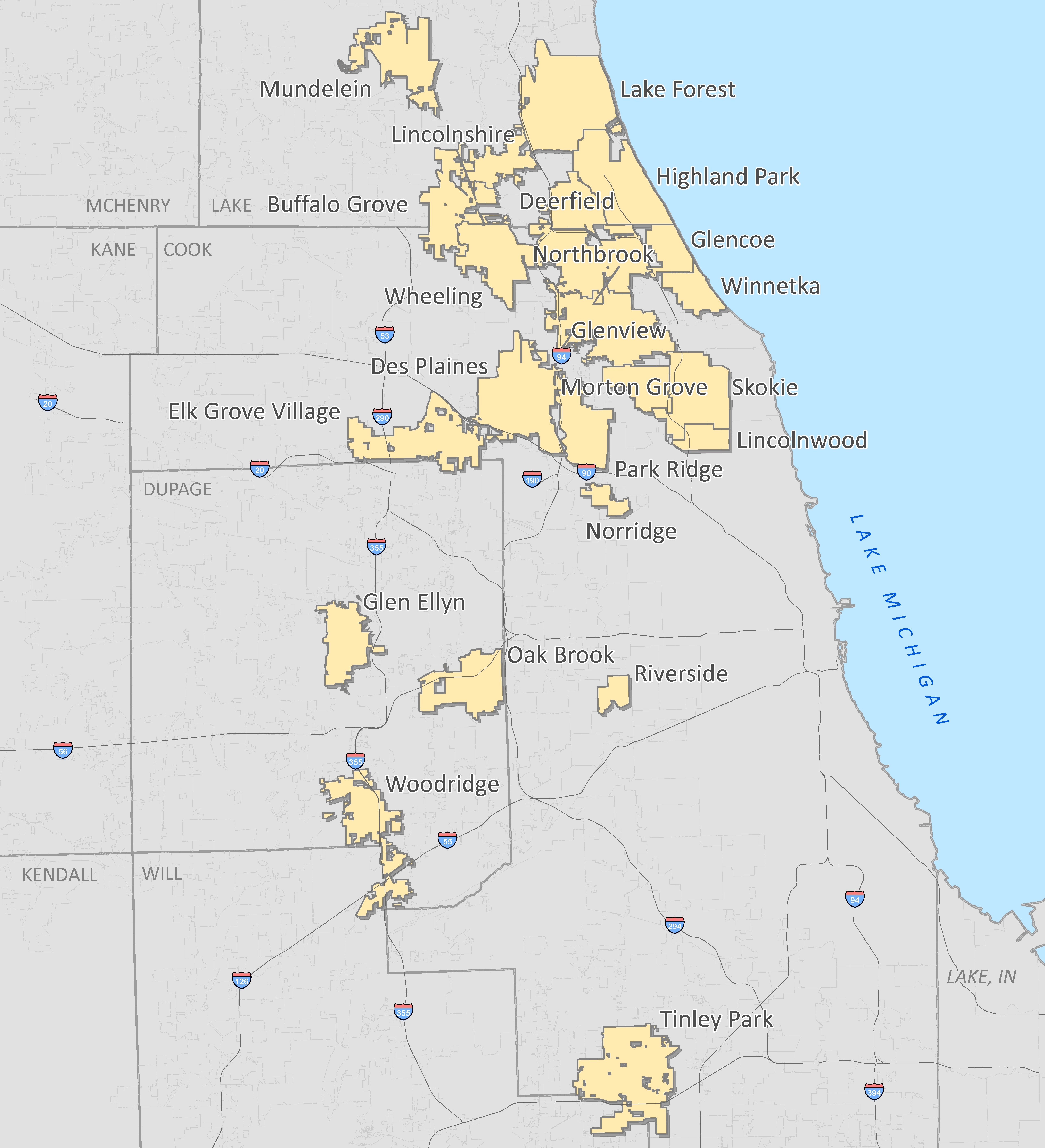
The Illinois-based GIS Consortium (GISC) is a group of 23 communities in the Chicago region that work together to develop GIS solutions to support a wide range of applications including municipal engineering, planning, forestry, and public safety.
 Ayres Associates has been providing high-accuracy mapping and surveying services to member communities since the 1980s. The GISC recently awarded Ayres Associates a five-year renewal of geospatial services that will extend our partnership with the Consortium through at least 2018.
The GIS Consortium continues to expand the use of digital cameras for specialized municipal mapping applications. This technology has allowed the participants to acquire high accuracy, high resolution aerial imagery at a lower cost. Unit pricing based on volume of participation has also translated to significant savings – discounts up 40% are being realized for individual communities. We offer the benefits of this cooperative effort to all communities in the area; formal membership in the Consortium is not required.
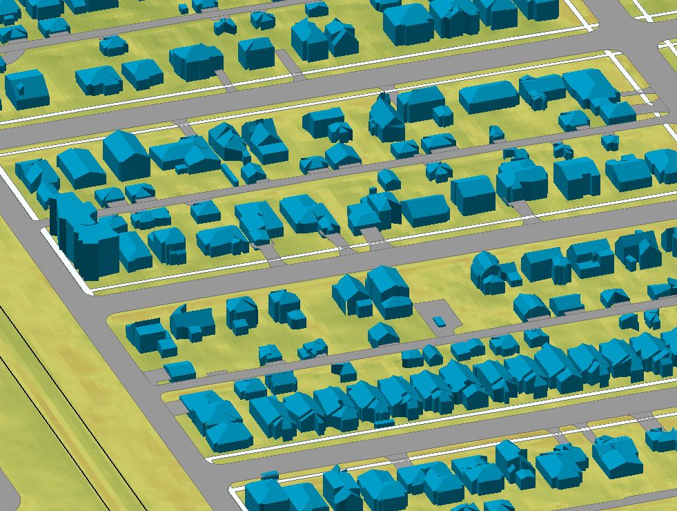
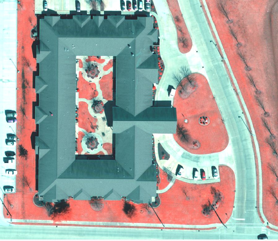
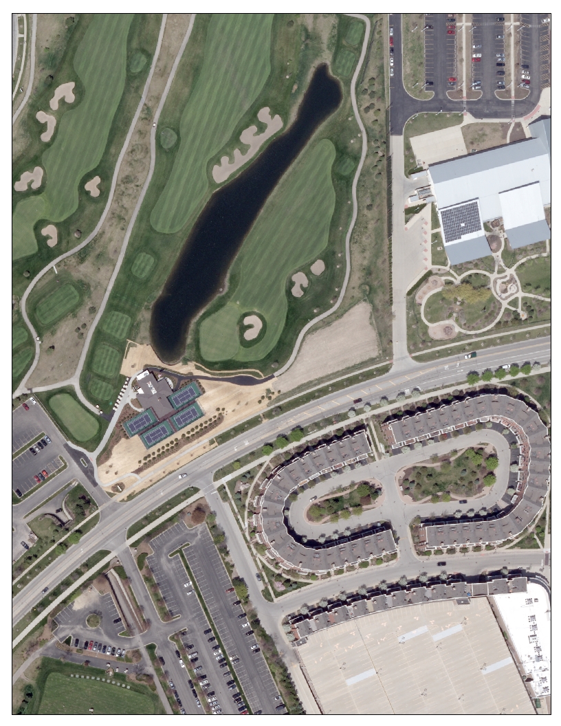
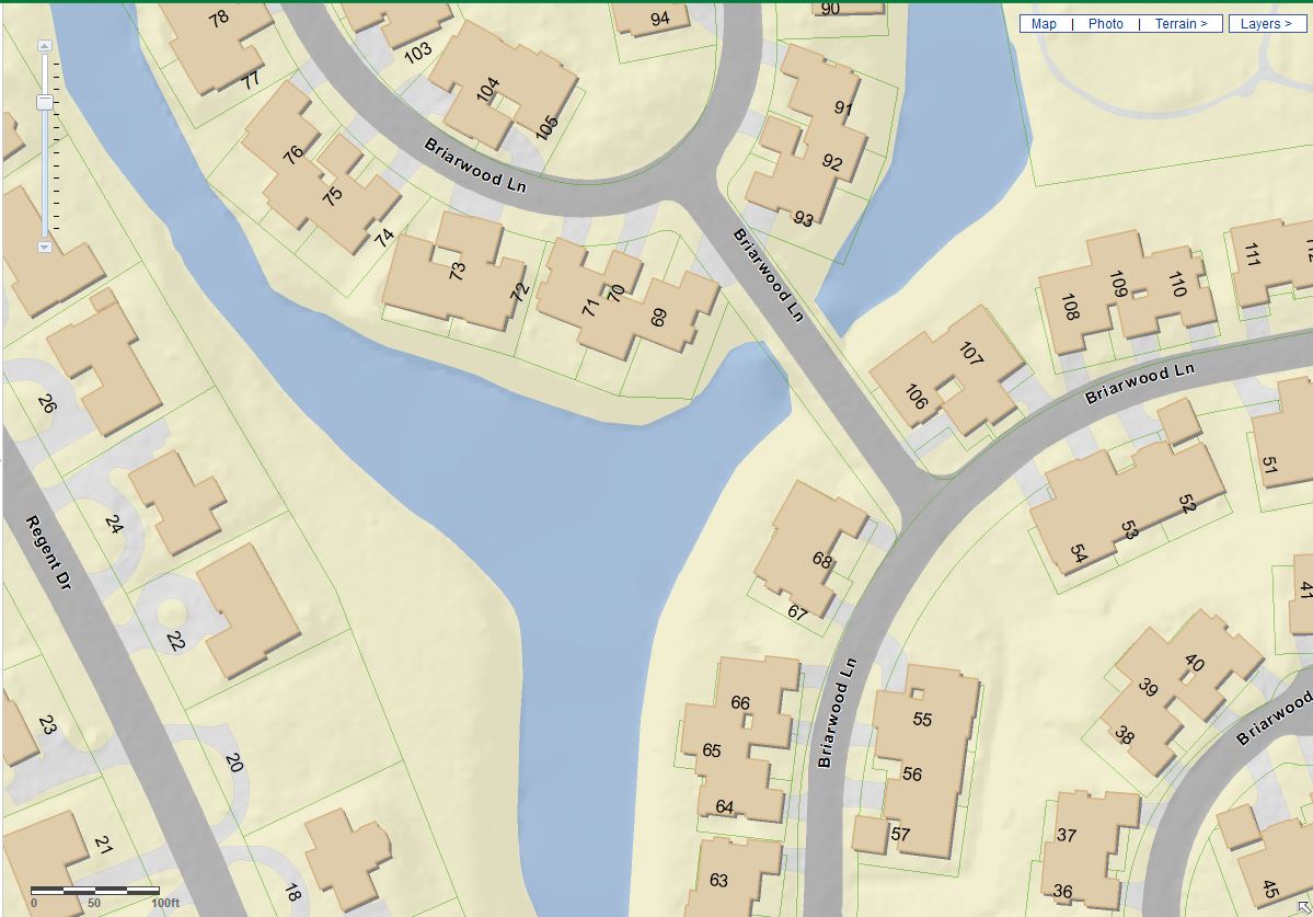
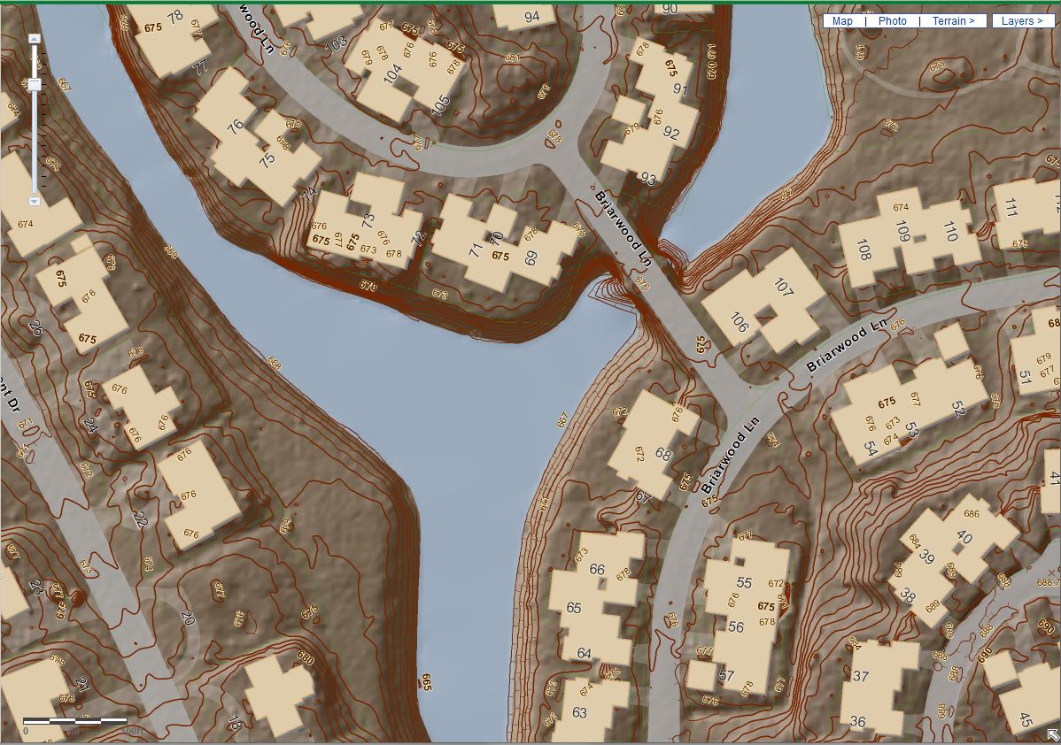
Aerial missions are conducted annually to maintain up-to-date base mapping data, consisting of 3-inch resolution orthoimagery, 1” = 50’ scale planimetrics, and 1-foot interval contours derived from high resolution LiDAR. Ancillary products have included leaf-on aerial imagery for urban forestry, 3D modeling of structures, and tall building-lean mitigation in business districts.
 In addition to LiDAR and aerial imagery collected each spring, several communities have participated in summer “leaf-on” flights in support of urban forest management. Invasive species, including the emerald ash borer, are having a significant impact on urban ecology. Understanding urban tree health and diversity is now more important than ever. Infrared imagery has become an important tool for this analysis and is now being employed by communities in your area.
Most of the GISC falls within a 10-nautical-mile radius of Chicago’s O’Hare International Airport. This is one of the most difficult airspace environments in the United States and presents unique challenges every flying season. Ayres Associates has built strong relationships with the Federal Aviation Administration (FAA), TRACON, and the O’Hare Air Traffic Control Tower. Recurring temporary flight restrictions add another dimension to security restrictions in the vicinity.
For more information about the organization, please visit: www.gisconsortium.org
More about the GIS Consortium: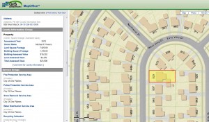
The GIS Consortium (GISC) is a public entity consisting of local governments that work collectively to achieve the benefits of GIS and related technologies. The mission of the GIS Consortium is to create value by managing cost and risk within an environment of cooperation where all members, regardless of size will succeed. Private industry plays a role in this model to the extent that it can provide specialized aspects of these systems. This partnership provides an environment where success is predictable and costs are contained.
 The GIS Consortium recognizes that small- and medium-size communities face special challenges when implementing technology. By collaborating communities unlock opportunities otherwise unavailable because of complexity or cost. The GIS Consortium is a public entity formed under a state statute that encourages Intergovernmental Agreements between units of local government. Above all, the GIS Consortium works to foster cooperation to solve common problems.
The GIS Consortium is recognized as a strategic partner in the greater-Chicago region GIS industry. Organizations that share our values of efficiency and cooperation are seeking our advice. As we all face new challenges in these economic times it is important to work cooperatively. The GIS Consortium stands as a symbol of what the future of local government may look like.


Recent Comments