3D Urban Modeling in the Chicago Suburbs
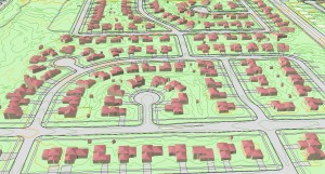 Advancements in Lidar processing tools and techniques are enabling new 3D modeling possibilities for GIS.
 Ayres Associates acquired high density Lidar of Tinley Park, Illinois in the spring of 2014. The primary objective of the project was the development of 1-ft interval contours and a bare earth surface model for stormwater management applications. However, there is tremendous value in the point cloud beyond the topographic information. We used this opportunity to test the ability of software to perform semi-automated feature extraction of structures and vegetation.
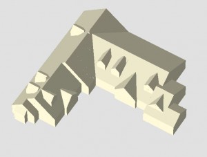
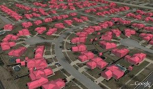
As an example, 3D buildings can now be generated from Lidar point clouds and imported into the GIS environment. Our Lidar processing software is able to detect and model 3D planes of building roofs and extrude building sides down from the roof edge to the ground. Despite being a fairly automated process, some degree of manual editing and analyzing tolerance levels for the software is still required. To improve results, we recommend advanced editing of the point cloud and post-editing of polygons within a GIS environment.
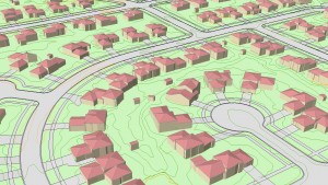 For a typical project for 1-ft contour generation we recommend the acquisition of Lidar at approximately 4 points per square meter. For the Tinley Park effort, we acquired the Lidar at 20 points per square meter.
We are demonstrating to our municipal clients in the Chicago area that the increased point density can be achieved at relatively little additional cost. This investment can now permit efficient methods for creating 3D GIS data which can be used for planning, zoning, public safety, and many other municipal departments.
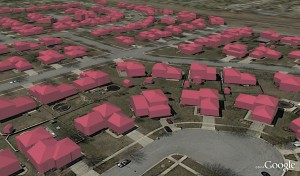
The images below depicts 3D buildings imported into Google Earth Pro:
Please see our previous article regarding high density Lidar applications for urban forestry:
 Advancements in Lidar processing tools and techniques are enabling new 3D modeling possibilities for GIS.
 Ayres Associates acquired high density Lidar of Tinley Park, Illinois in the spring of 2014. The primary objective of the project was the development of 1-ft interval contours and a bare earth surface model for stormwater management applications. However, there is tremendous value in the point cloud beyond the topographic information. We used this opportunity to test the ability of software to perform semi-automated feature extraction of structures and vegetation.
 For a typical project for 1-ft contour generation we recommend the acquisition of Lidar at approximately 4 points per square meter. For the Tinley Park effort, we acquired the Lidar at 20 points per square meter.


Recent Comments