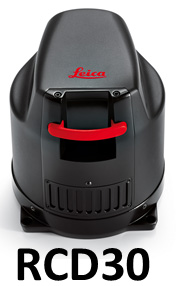
Ayres’ RCD30 digital camera provides surveyors with the ability to economically and quickly acquire aerial photography to support field operations.
The Land Survey and Green Bay Municipal engineering groups of Ayres Associates are working with the Village of Denmark, WI (10 miles from Green Bay) in an effort to develop an industrial park on the west side of Interstate 43.
The development will require the preparation of a Certified Survey Map (CSM) and plat maps. Knowing that the site would eventually be planted with corn before field work could be conducted, the surveyors wanted the ability to capture a snapshot of the site before the ground was obscured by crops.
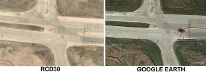
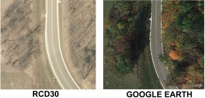
The Solution: Although Google Earth imagery presents a simple and free option, the poor resolution of the Google imagery does not reveal important details on the ground and does not reference any degree of accuracy. Additionally, it is difficult to determine if Google imagery sufficiently represents current conditions of the site as the dates of its capture are often unknown. With this in mind, the surveyors turned to the Aerial Mapping group for an alternative solution.
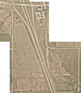
 In May 2014 the Ayres RCD30 digital camera was in the midst of several missions to collect aerial photography at National Guard sites throughout the State. This gave us the ability to efficiently fly over the Denmark site between project areas at very low cost- and before crops would obscure the ground. The surveyors provided a project area boundary and ground control targets. The flight plan was prepared to support 3″ resolution imagery. It was also planned to support 1-ft contours if topographic mapping is eventually needed as well.
Because of the many RCD30 mission conducted throughout the year, we can provide high quality aerial imagery for small sites… on short-notice and at very low cost.
The high resolution, high accuracy orthophotography for this site was accomplished with very low labor and equipment costs. This provides the engineers and surveyors with a clear and up-to-date picture of the site for planning purposes and can be used to create large-format exhibits for display.
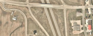
Below are comparisons of Google Earth imagery vs. the high resolution imagery from the RCD30 (click on images to view enlargements and zoom in to see detail).




Recent Comments