Surveying Steamboat Lake – Above and Below the Water Line
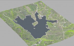 Merging Bathymetric Survey and Aerial Lidar
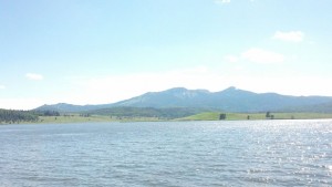
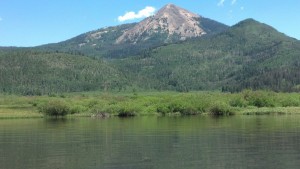
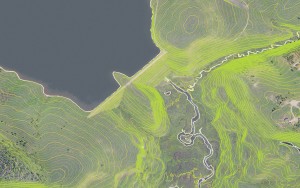 Ayres Associates is supporting the analysis of the Steamboat Lake with integrated bathymetric and aerial Lidar survey. Working with GeoSurv Inc. of Lafayette, CO, Ayres conducted a survey of the lake bottom and sub bottom – merging the data with topographic mapping collected from an aerial Lidar mission.
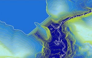 The survey being conducted for Colorado Parks and Wildlife is supporting an effort to measure the current volumetric capacity of the reservoir and evaluation of methods for increasing its capacity. Whether exploring options such as rising the height of the dam and/or through dredging, engineers first need to view and measure a continuous surface model consisting of the Lake’s bathymetry and surrounding topography.
Lidar was acquired in June of 2014 at approximately 5 points per square meter to support a vertical accuracy which exceeds 18.5cm RMSE (0.61-ft). Imagery was captured simultaneously with the Lidar and was processed to 6-inch resolution.
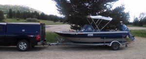
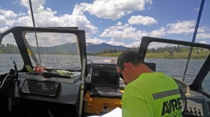 For the bathymetry, a two man crew and 18’ prop v-bottom boat was used to cut bathymetry sections at 400ft spacing on the lake with cross profiles for quality control. This was performed with a survey grade depth sounder and GPS where the depth is greater than 1ft. Shallow wading shots were also collected and tied into the overbank.
 For the Sub Bottom Profile and Deposition Volume, Ayres used a Ross 4910 dual frequency Sub-Bottom Profiler. Ayres then calculated sediment volume after field calibration.
 Merging Bathymetric Survey and Aerial Lidar
 Ayres Associates is supporting the analysis of the Steamboat Lake with integrated bathymetric and aerial Lidar survey. Working with GeoSurv Inc. of Lafayette, CO, Ayres conducted a survey of the lake bottom and sub bottom – merging the data with topographic mapping collected from an aerial Lidar mission.
 The survey being conducted for Colorado Parks and Wildlife is supporting an effort to measure the current volumetric capacity of the reservoir and evaluation of methods for increasing its capacity. Whether exploring options such as rising the height of the dam and/or through dredging, engineers first need to view and measure a continuous surface model consisting of the Lake’s bathymetry and surrounding topography.
 For the bathymetry, a two man crew and 18’ prop v-bottom boat was used to cut bathymetry sections at 400ft spacing on the lake with cross profiles for quality control. This was performed with a survey grade depth sounder and GPS where the depth is greater than 1ft. Shallow wading shots were also collected and tied into the overbank.
 For the Sub Bottom Profile and Deposition Volume, Ayres used a Ross 4910 dual frequency Sub-Bottom Profiler. Ayres then calculated sediment volume after field calibration.


Recent Comments