Tracking Impact of Emerald Ash Borer from Aerial Imagery

Ayres Associates is providing specialized infrared aerial imagery and LiDAR tools for urban tree canopy analysis in the Chicago area.
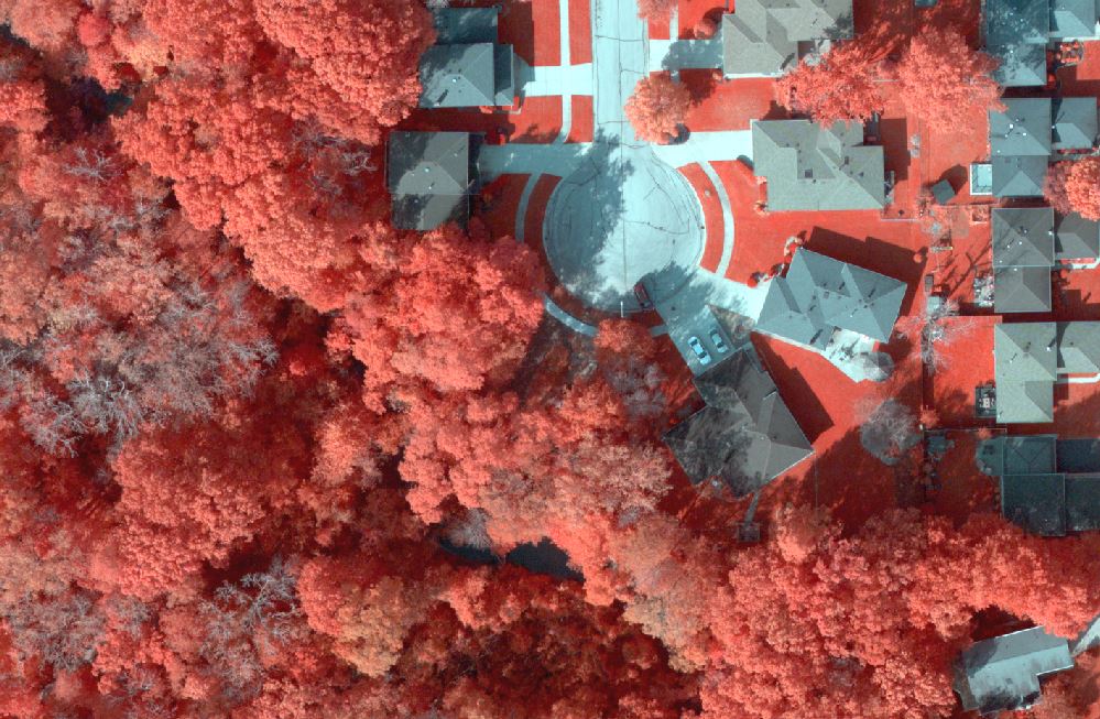
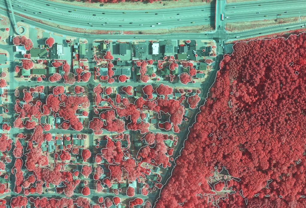
Municipalities are taking extraordinary measures to deal with the impacts of the Emerald Ash Borer on urban forests. Aerial imagery may provide a useful tool for detecting dead and dying trees and for tracking the decline in the tree canopy.
A recent survey of tree species by the Village of Tinley Park has revealed that most of its 11,000 ash trees within public property had been infested by the invasive beetle. The results are devastating – much of the urban forest canopy was already dying when the Village made the difficult decision to remove nearly 10,000 susceptible trees within those public areas. Here’s a link to an article on the Village’s website which details their efforts to remove and replace ash trees within public areas: www.tinleypark.org/index.aspx?nid=648
 Although Tinley Park and other communities are taking an aggressive approach to combat this beetle, their efforts are focused on the public spaces. However, many susceptible or dead ash trees remain on private lands where they are no less a problem. These dead and dying trees still have significant impacts on municipalities and pose potential safety hazards for homeowners. A contraction of urban forest may impact stormwater runoff- causing
  localized flooding and erosion. Loss of tree canopy may also lead to reduction in air quality and higher cooling costs in the summer. Dead and stressed trees can also pose threats when they lose large limbs or topple.
To help communities prepare for these impacts, Ayres Associates has been working to develop methodologies for mapping urban forests. With our efforts in the Chicago area, we are building workflows to accomplish 3 primary goals using geospatial tools that includes aerial imagery and high density Lidar:
-
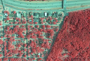 Change of Tree Canopy Extent. Automated extraction of canopy extent is performed from leaf-on aerial imagery collected in 2012 and 2014. Lidar is also used to attribute canopy height and volume.
-
Identifying Ash Trees. “Just-in-time” aerial imagery is collected when ash trees exhibit unique signatures in Infrared imagery. Ground  truth information is utilized to train our software to detect trees with similar imagery attributes. Knowing where ash trees exist in the public space allows us to detect them in private lands and areas of dense, continuous-canopy forests.
-
Identify Dead/Dying Trees. High resolution imagery supports the detection of dead and dying trees. NDVI images also provide an index of vigor/health for individual trees.
There may be no stopping the Emerald Ash Borer, but communities and  homeowners can be prepared to deal with the impacts of this beetle. Aerial imagery and Lidar can be a useful tool for detecting issues and for managing a healthy urban tree canopy.


Recent Comments