HD Scanning – Another Tool in the Toolbox
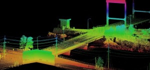
In addition to providing high accuracy survey, HD Laser Scanning enables workload and staffing flexibility for the Geospatial Division.
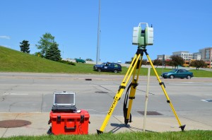 HD Laser Scanners create a highly detailed and precise point cloud. After collecting and calibrating the data in the field, the work of measuring and extracting the detailed information for CAD drawings occurs back at the office. This workflow represents a high degree of cooperation between the Survey and Aerial Mapping groups at Ayres Associates: the surveyors perform the scan and calibrate the data to known coordinates while the Lidar technicians in the Aerial Mapping group use specialized software for data extraction. The shared resources and expertise allows us to quickly respond to our clients’ survey needs even during peak workload.
 Whether preparing a CAD drawing for transportation design or electrical engineering applications, our two groups provide the combined expertise to efficiently survey and map any site. Together we also possess a wide range of specialized software – each tailored to a specific application.
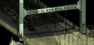
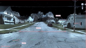
The graphics to the right depict Lidar point cloud images as represented in Leica’s 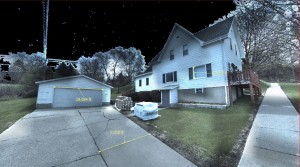 TrueView software. This Internet Explorer-based add-on enables a viewer to easily prepare 3D measurement and output displays for quick reference.
To derive the data for CAD drawing, the Aerial Mapping group utilizes TopoDOT and Cardinal VrOne, both common tool for DOT and transportation design mapping.
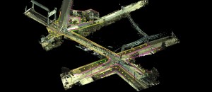
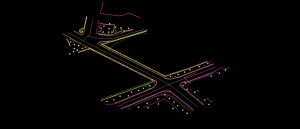
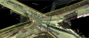
The images below show the planimetrics and DTM breaklines extracted from the Lidar point cloud in a Microstation environment. The 3D drawings can then formatted to DOT or other client-specific specifications in Microstation or Civil3D.
Please see our previous post from July 15 for additional information related to data extraction from HD Scanning.

 HD Laser Scanners create a highly detailed and precise point cloud. After collecting and calibrating the data in the field, the work of measuring and extracting the detailed information for CAD drawings occurs back at the office. This workflow represents a high degree of cooperation between the Survey and Aerial Mapping groups at Ayres Associates: the surveyors perform the scan and calibrate the data to known coordinates while the Lidar technicians in the Aerial Mapping group use specialized software for data extraction. The shared resources and expertise allows us to quickly respond to our clients’ survey needs even during peak workload.
 Whether preparing a CAD drawing for transportation design or electrical engineering applications, our two groups provide the combined expertise to efficiently survey and map any site. Together we also possess a wide range of specialized software – each tailored to a specific application.
 TrueView software. This Internet Explorer-based add-on enables a viewer to easily prepare 3D measurement and output displays for quick reference.


Recent Comments