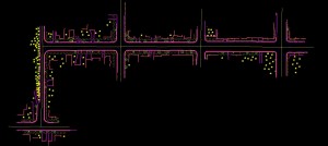
Laser scanners provide a unique perspective for municipal survey and mapping.
A 3D point cloud generated using a Leica P20 Laser Scanner is used by our Lidar specialists to extract digital terrain data and planimetrics- recreating traditional CAD-based mapping compiled from conventional survey and photogrammetry.
For this example, we compiled curb and gutter, utilities, improvements, and other structures along a road corridor and several intersections. The mapping derived for this municipality in northeaster Wisconsin was compiled to match typical DOT specifications.
 Laser Scanning can also be used to generate 3D streetscapes and building facades for planning and zoning applications. Feature extraction of utilities and other municipal assets can be accurately collected for integration into GIS geodatabase.


Recent Comments