

 Ayres Spatially Integrated Video (SIV) system provides a low-cost solution for recording and gathering street level information. We have developed this application to support a wide range of municipal and highway applications, including pavement/road condition analysis, pre-construction documentation, and asset/infrastructure inventory.
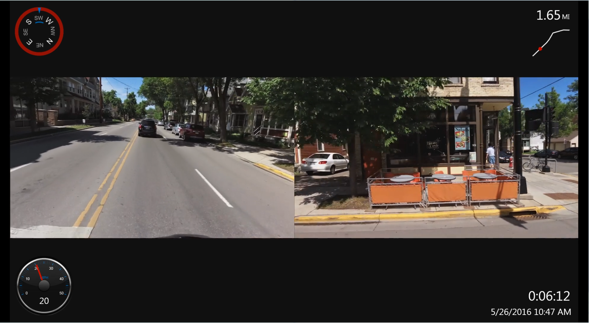
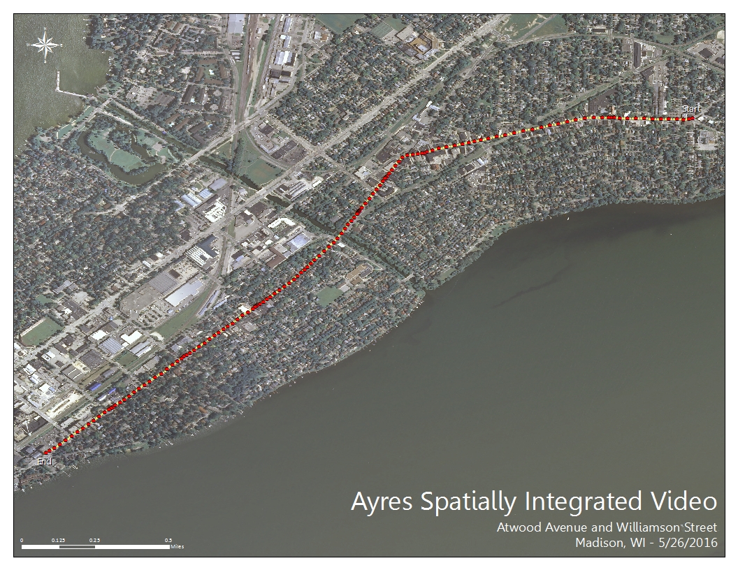
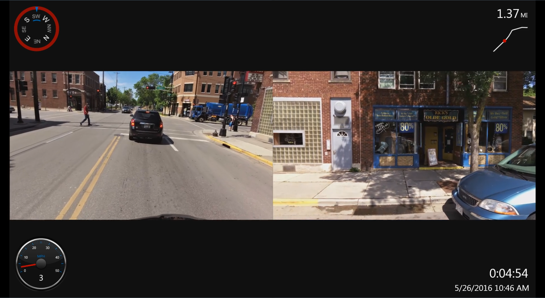
Recent advancements in our approach have  enabled us to simultaneously capture geo-referenced videos from multiple angles resulting in a broader picture of the assets. This is particularly useful where a traditional “windshield survey” may not efficiently capture and record information about a corridor or streetscape.
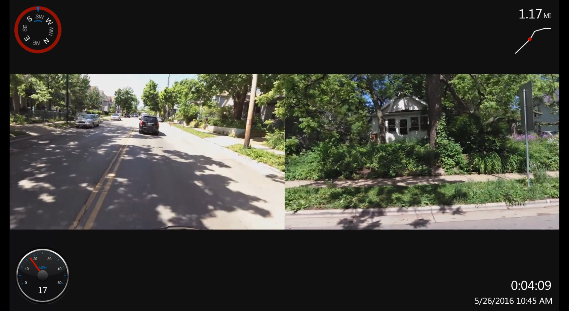

 The geo-referenced video can be formatted for play-back within a GIS platform. Road centerlines representing each segment are generated from the GPS data and output as shapefiles. These vectorized centerlines can be attributed with qualitative and quantitative information such as road names, date and time of capture, and observations. Additionally, date and time stamps can be inserted into the individual videos showing the exact date and time a video was collected.
The system is readily deployable necessitating only a brief setup after which data collection can be initiated remotely and viewed in real-time by the operator on Wi-Fi capable tablets or smart phones.


Recent Comments