Category Archive: LiDAR

Jul 15

Street Level Mapping from Laser Scanner

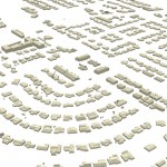
Laser scanners provide a unique perspective for municipal survey and mapping. A 3D point cloud generated using a Leica P20 Laser Scanner is used by our Lidar specialists to extract digital terrain data and planimetrics- recreating traditional CAD-based mapping compiled from conventional survey and photogrammetry. For this example, we compiled curb and gutter, utilities, improvements, and other structures along a …

Continue reading »

May 28

Tree Canopy Mapping from LiDAR in Chicago Region

Urban Tree Canopy Mapping in Tinley Park, IL. Ayres Associates derived tree crown and centroid data in the Village of Tinley Park using fixed-wing aerial LiDAR acquired at ~ 20 points per square meter. Individual tree crowns and centroids were prepared in shapefile format along with a rasterized Canopy Height Model (CHM). These vectorized features are attributed with calculated statistics …

Continue reading »

Apr 20

Municipal Geospatial Partnerships

Geospatial data such as topographic mapping, aerial imagery, and planimetrics create the digital foundation for any engineering project.  If you manage floodplains and storm water your first priority should be obtaining accurate up to date topographic data.  Flooding is not the only application that benefits greatly from geospatial data.  The potential applications for quality geospatial …

Continue reading »

Apr 14

NoCO (Northern Colorado) Geospatial Consortium

Local municipal governments in northern Colorado team-up to build high accuracy base mapping through LiDAR and aerial imagery.   Ayres Associates worked with several local governments throughout northern Colorado to form an informal consortium with map modernization as their primary objective. This group broadly consists of the City of Fort Collins, City of Loveland, Larimer …

Continue reading »

Apr 05

Mobile LiDAR for Transportation Design Mapping

Ayres Associates provided Mobile LiDAR services for the Interstate 43 corridor in Milwaukee and Ozaukee Counties in Wisconsin.  The project consists of approximately 50 total linear miles of Mobile LiDAR collection to support survey grade data. A digitally leveled primary and secondary control network was established. LiDAR and digital imagery was collected to maximize detection of …

Continue reading »

Mar 28

The GIS Consortium – a role model for municipal cooperation

The Illinois-based GIS Consortium (GISC) is a group of 23 communities in the Chicago region that work together to develop GIS solutions to support a wide range of applications including municipal engineering, planning, forestry, and public safety.     Ayres Associates has been providing high-accuracy mapping and surveying services to member communities since the 1980s. …

Continue reading »

Mar 20

Mapping Transmission and Distribution Lines with Fixed-wing Lidar Systems

Ayres Associates is mapping transmission lines in the Rocky Mountains of Colorado through the use of fixed-wing Lidar systems.  Poles, conductors, and utility structures are being extracted from high density Lidar point clouds and modeled as vectors in a geodatabase. Much of the focus on as-built transmission surveys over the past few years has been …

Continue reading »

Mar 05

Feature Extraction from Aerial LiDAR

Last post I touched on how you can get more from your aerial LiDAR data – beyond contours and surface models. For more information on the topic, revisit my presentation from the 2014 Wisconsin Land Information Association Conference. Topics covered include feature extraction for buildings and vegetation, in addition to electric transmission and distribution applications. …

Continue reading »

Mar 05

3D Building Extraction from Aerial LiDAR

Get more information from your aerial LiDAR – beyond contours and surface models. Recent advances in LiDAR systems and software are leading to new tools for extracting valuable information from point clouds. High-density point clouds can be used to extract 3D building shapefile polygons using customized algorithms inTerrasolid’s TerraModeler software. Complex 3D building models are …

Continue reading »

» Newer posts