

Local municipal governments in northern Colorado team-up to build high accuracy base mapping through LiDAR and aerial imagery.
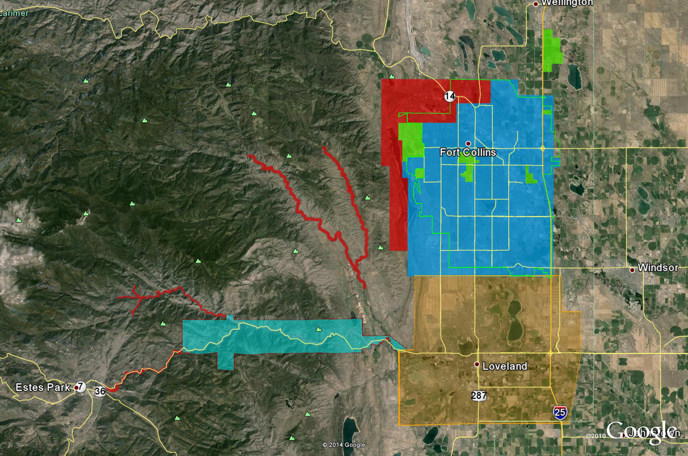 Ayres Associates worked with several local governments throughout northern Colorado to form an informal consortium with map modernization as their primary objective. This group broadly consists of the City of Fort Collins, City of Loveland, Larimer County, and Colorado State University (CSU). A myriad of City and County departments from within these entities were included as important stakeholders in the project. This partnership enabled the participants to update their base mapping data at significant cost savings over a go-it-alone approach and provided an opportunity to economically upgrade to a higher accuracy product.
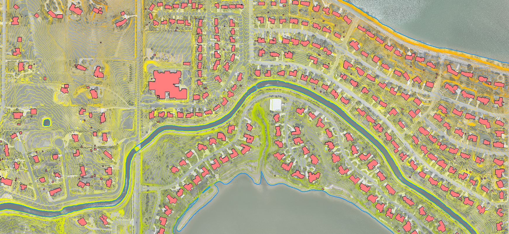
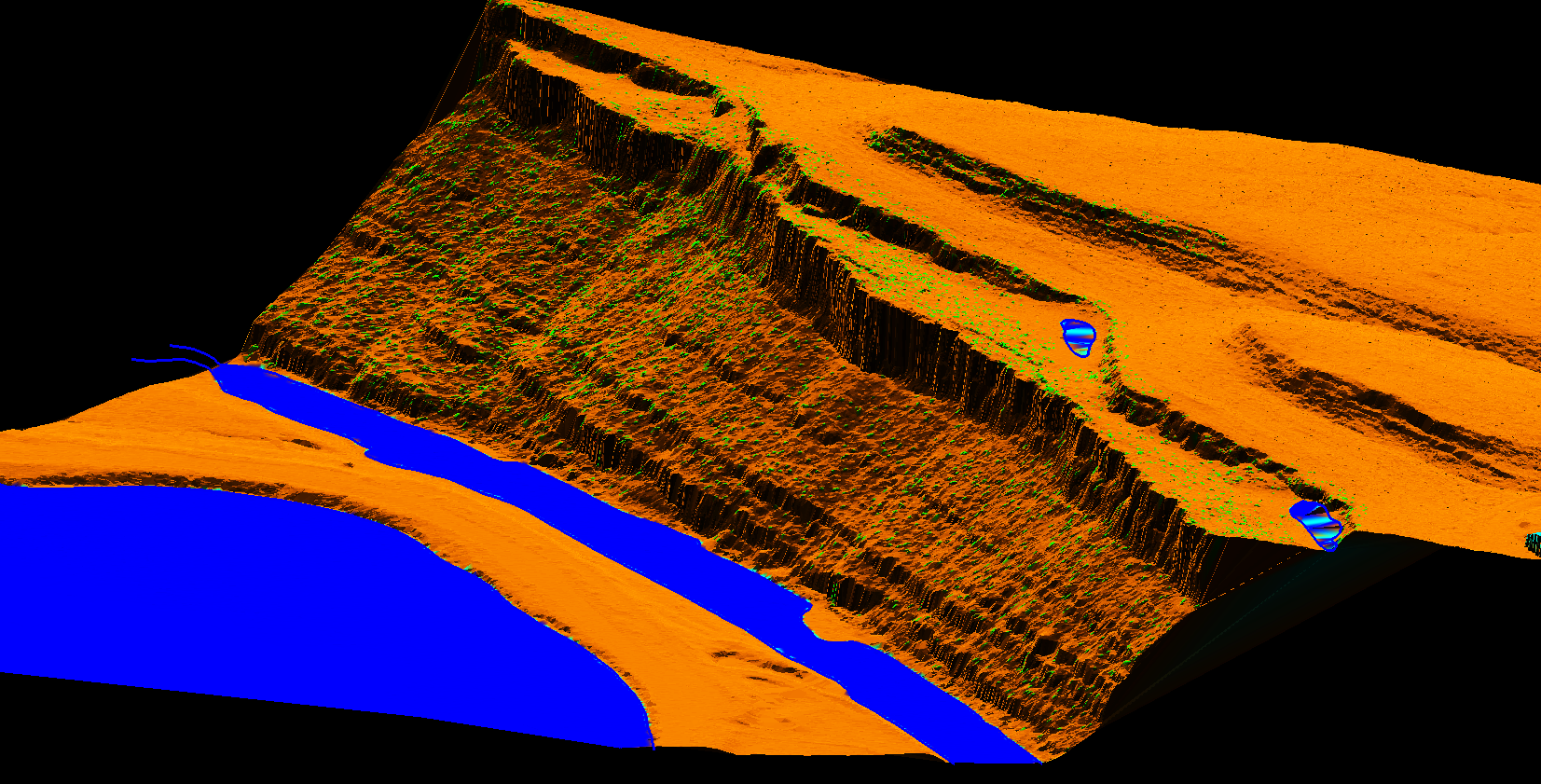
 Through this cooperative effort, these participants received 3-inch resolution digital orthoimagery and 1-ft interval contours derived from LiDAR. These products were standardized to create a seamless product across all participating jurisdictions. Imagery was collected by Ayres Associates in April 2013 using the Microsoft UltraCam digital imaging system. The LiDAR was collected in the same timeframe using the Riegl LMS-Q680i system. The LiDAR was classified and edited to support FEMA accuracy standards. Hydro-flattening breaklines were compiled from the LiDAR intensity images in a 3D environment. A FEMA compliant accuracy report was conducted using independent, GPS surveyed check points distributed throughout the project area.
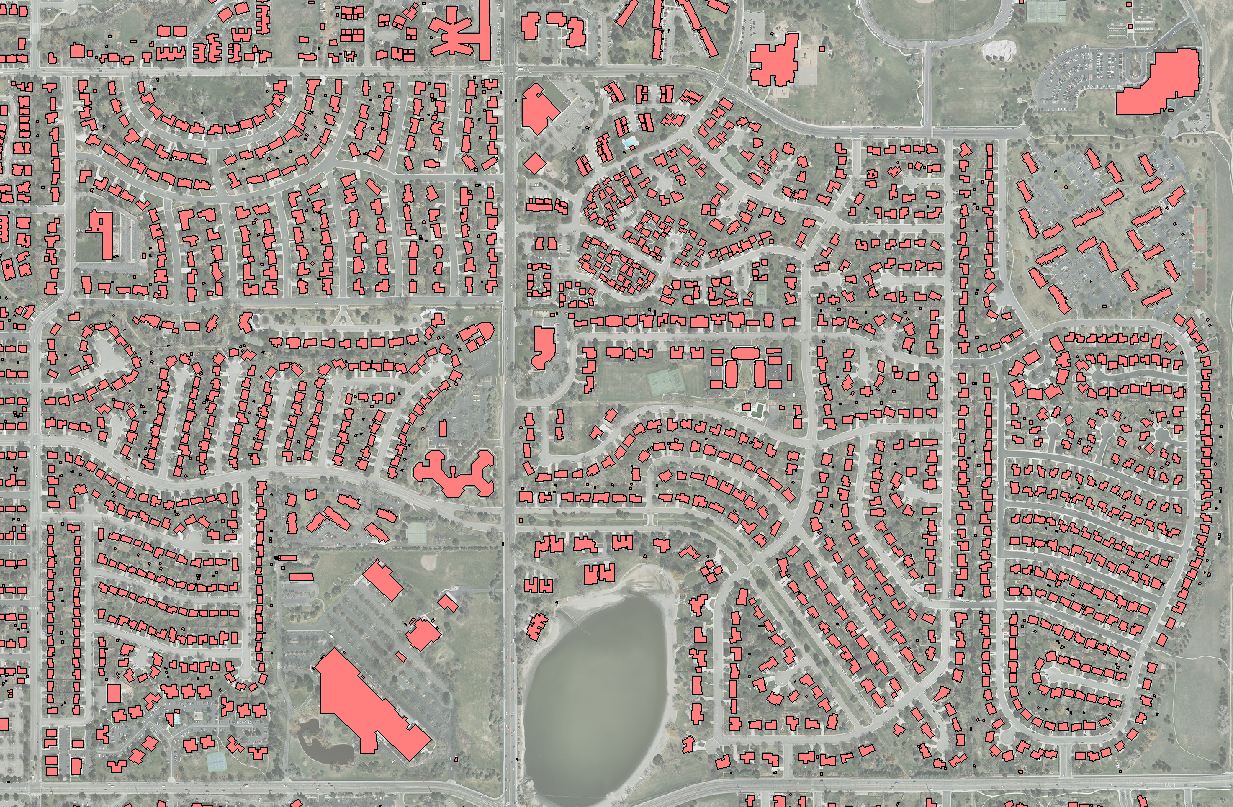
Beyond these standardized products, the communities developed additional customized planimetric products tailored to specific needs. For example, Fort Collins received building footprints for the entirety of the City’s Growth Management Area (GMA), approximately 77 square miles. The City of Loveland collected electric distribution assets within their municipal electric service areas west of the City.
Project Facts: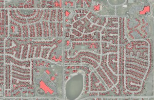
Total Area Mapped: 260 square miles
Imagery and LiDAR Acquisition Dates: April 15-30, 2013
Total number of images collected: 5135
Number of buildings mapped in Fort Collins: 77,271
Calculated RMSEz of the LiDAR (Vertical Accuracy): 0.178’


Recent Comments