Jason Krueger

Author's details

Name: Jason Krueger
Date registered: March 20, 2014

Biography

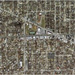
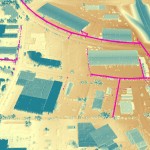
I am a project manager in Ayres’ geospatial operations in Madison, Wisconsin. I have 17 years of experience with land information and mapping for public and private entities. I specialize in geospatial project design for municipal engineering and transportation design. Recent project assignments include considerable work for the Northern Colorado Consortium and the Illinois GIS Consortium, an organization of 23 municipalities in the Chicago area

Latest posts

  1. Unmanned Aerial Systems – one tool in the geospatial toolbox — May 24, 2019
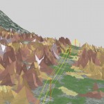
  2. High Density Lidar for Colorado DOT Applications — December 20, 2017
  3. Baselines are Critical for Asset Management Solutions — October 11, 2017
  4. Capturing an Impressive Display of Aviation History — August 10, 2017
  5. Ayres Associates Works with Kids at the Children’s Water Festival in Fort Collins, CO — June 9, 2017

Most commented posts

  1. Mapping Transmission and Distribution Lines with Fixed-wing Lidar Systems — 3 comments
  2. Land information gathering highlights best of Wisconsin — 3 comments
  3. Ayres Spatially Integrated Video System — 1 comment
  4. Ayres Shares New Oblique Solution at UMGEOCON ’16 — 1 comment

Author's posts listings

Apr 20

Municipal Geospatial Partnerships

Geospatial data such as topographic mapping, aerial imagery, and planimetrics create the digital foundation for any engineering project.  If you manage floodplains and storm water your first priority should be obtaining accurate up to date topographic data.  Flooding is not the only application that benefits greatly from geospatial data.  The potential applications for quality geospatial …

Continue reading »

Apr 14

NoCO (Northern Colorado) Geospatial Consortium

Local municipal governments in northern Colorado team-up to build high accuracy base mapping through LiDAR and aerial imagery.   Ayres Associates worked with several local governments throughout northern Colorado to form an informal consortium with map modernization as their primary objective. This group broadly consists of the City of Fort Collins, City of Loveland, Larimer …

Continue reading »

Apr 05

Mobile LiDAR for Transportation Design Mapping

Ayres Associates provided Mobile LiDAR services for the Interstate 43 corridor in Milwaukee and Ozaukee Counties in Wisconsin.  The project consists of approximately 50 total linear miles of Mobile LiDAR collection to support survey grade data. A digitally leveled primary and secondary control network was established. LiDAR and digital imagery was collected to maximize detection of …

Continue reading »

Mar 28

The GIS Consortium – a role model for municipal cooperation

The Illinois-based GIS Consortium (GISC) is a group of 23 communities in the Chicago region that work together to develop GIS solutions to support a wide range of applications including municipal engineering, planning, forestry, and public safety.     Ayres Associates has been providing high-accuracy mapping and surveying services to member communities since the 1980s. …

Continue reading »

Mar 26

Congrats, Adam! WLIA President Elect

Adam Derringer, a Project Manager in the Geospatial Division of Ayres Associates was recently elected as President Elect of the Wisconsin Land Information Association (WLIA).  Adam has served on the Board of Directors for WLIA as well as on multiple committees for many years.    Adam explains, “It is a true honor and an even …

Continue reading »

Mar 20

Mapping Transmission and Distribution Lines with Fixed-wing Lidar Systems

Ayres Associates is mapping transmission lines in the Rocky Mountains of Colorado through the use of fixed-wing Lidar systems.  Poles, conductors, and utility structures are being extracted from high density Lidar point clouds and modeled as vectors in a geodatabase. Much of the focus on as-built transmission surveys over the past few years has been …

Continue reading »

Mar 05

Feature Extraction from Aerial LiDAR

Last post I touched on how you can get more from your aerial LiDAR data – beyond contours and surface models. For more information on the topic, revisit my presentation from the 2014 Wisconsin Land Information Association Conference. Topics covered include feature extraction for buildings and vegetation, in addition to electric transmission and distribution applications. …

Continue reading »

Mar 05

3D Building Extraction from Aerial LiDAR

Get more information from your aerial LiDAR – beyond contours and surface models. Recent advances in LiDAR systems and software are leading to new tools for extracting valuable information from point clouds. High-density point clouds can be used to extract 3D building shapefile polygons using customized algorithms inTerrasolid’s TerraModeler software. Complex 3D building models are …

Continue reading »

» Newer posts