

Monitor and Measure Your Aquatic Vegetation with the Latest Mapping Technology
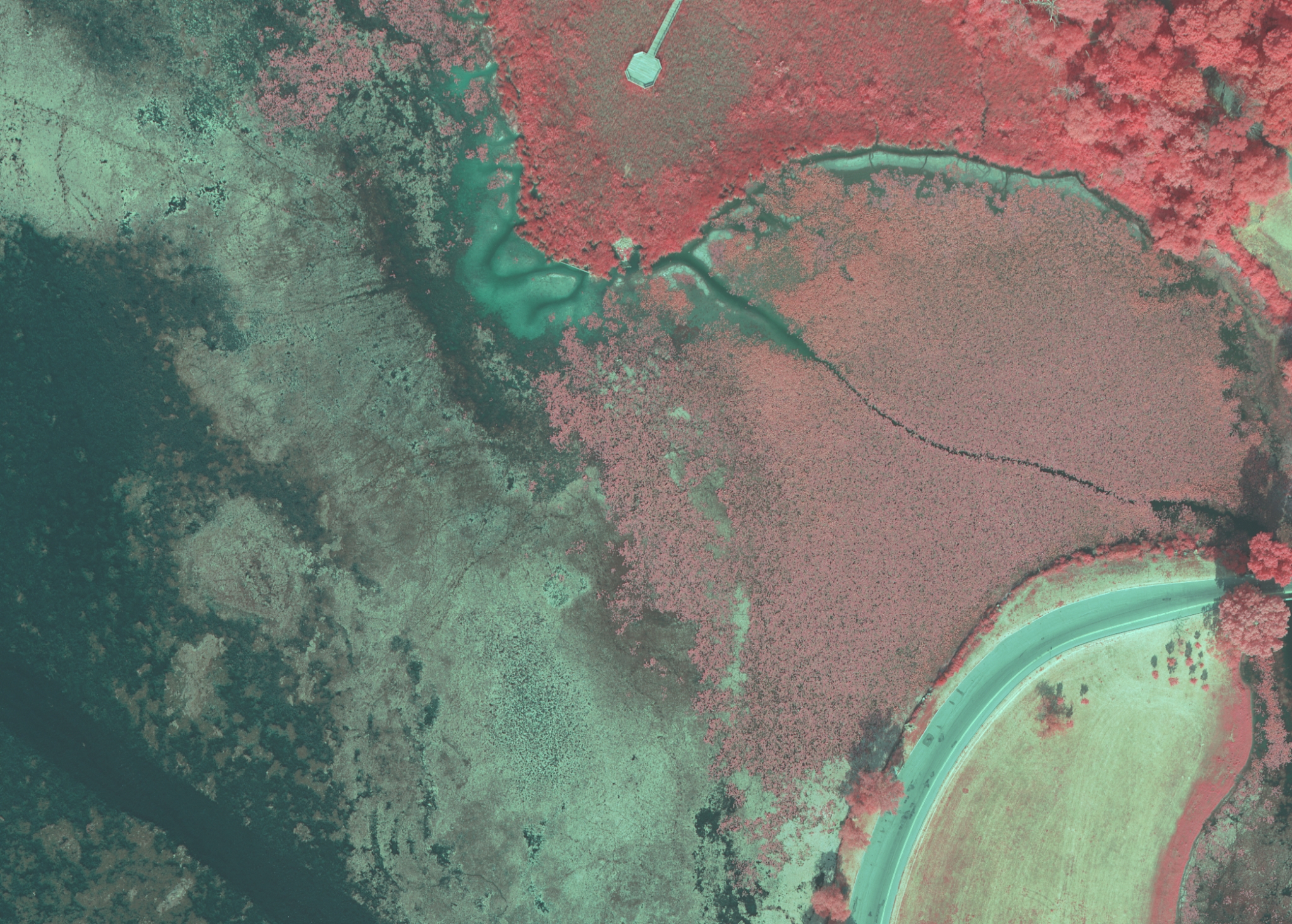
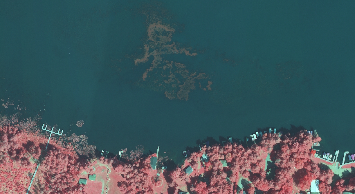
Monitoring the conditions of riparian areas is an integral part of protecting the health of aquatic ecosystems. Together with Applied Ecological Services (AES), our team at Ayres Associates has developed a method for mapping lakes and riparian zones from the air. Our partnership provides a blend of expertise in geospatial services and ecological science, which enables us to offer innovative services for lake managers across the United States. Equipped with our cutting-edge digital camera, we are able to collect highly detailed aerial imagery in both natural color and color infrared (IR) bands. The IR band responds to the chlorophyll in vegetation and therefore allows us to capture the location, composition and condition of aquatic plant communities.
We can use this technology to create high-resolution orthophotos that serve as a lake management planning tool. Utilizing these orthophotos, we are able to map existing aquatic plant populations, thereby identifying invasive species that may be present, and monitor changes that might occur throughout the season or year. For instance, by mapping blue-green algal blooms, we can determine the presence and size of potential toxic threats. Additionally, we have the capability of mapping invasive aquatic vegetation, erosion, bank stability and buffer vegetation, as well as document water quality variables and track sediment plumes.
A few of the benefits from this approach include reducing the need for labor-intensive manual plant identification, the ability to document the effectiveness of aquatic invasive control methods and increasing the analytical capabilities from an office environment. This method additionally allows users to modernize their records with GIS-ready imagery for base mapping and digitization of aquatic features. Most importantly, this new technology introduces another tool for improving the quality of our irreplaceable lakes.


1 ping
Geospatial Solutions for Urban Forest Management » Borders & Frontiers
April 18, 2014 at 11:20 am (UTC -6) Link to this comment
[…] develop a method for mapping urban forests from the air. As discussed in the previous article on monitoring aquatic vegetation, our RCD30 camera is designed for capturing 4-band multispectral imagery. The infrared band […]