

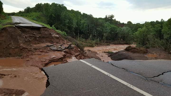
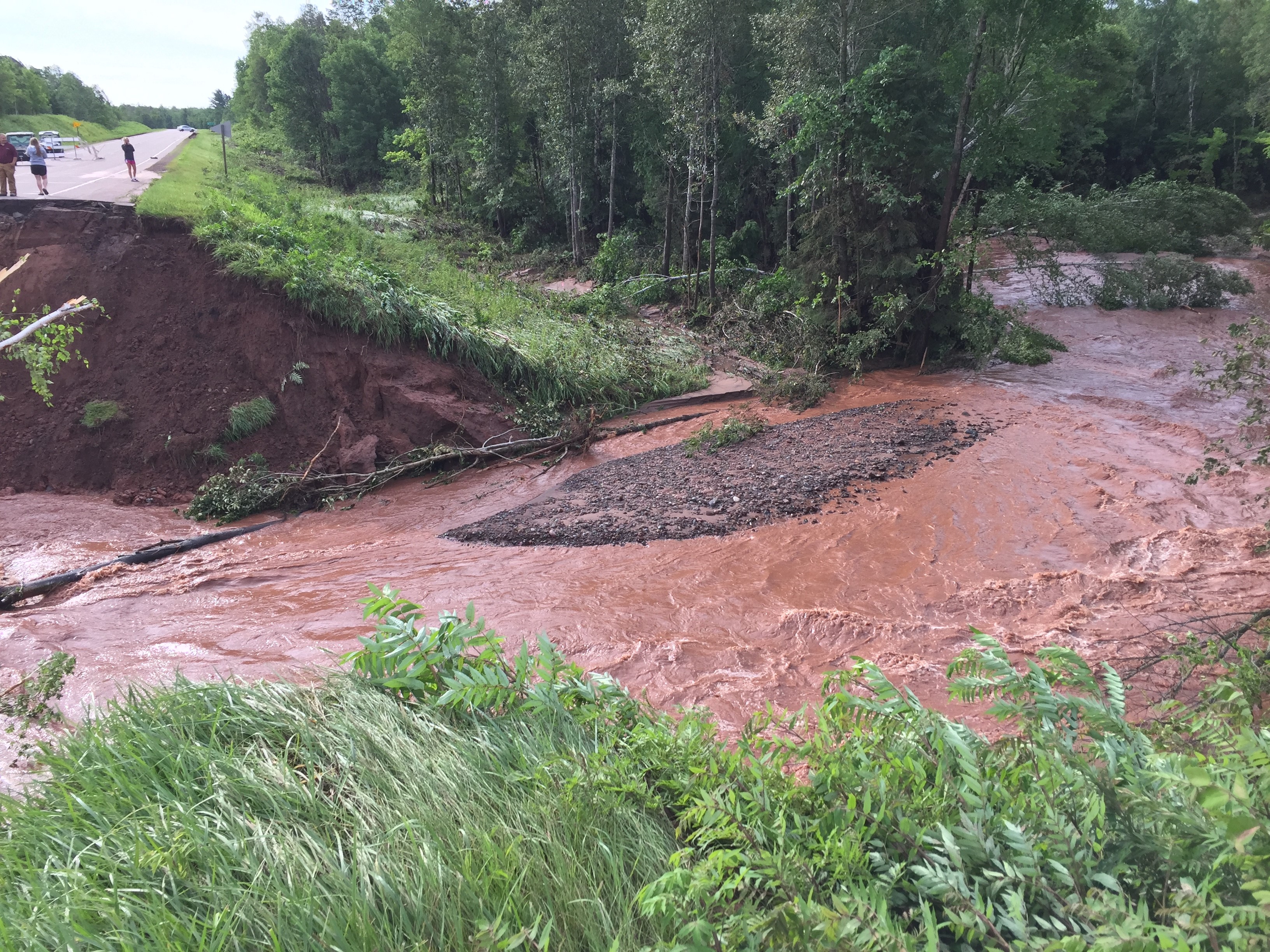
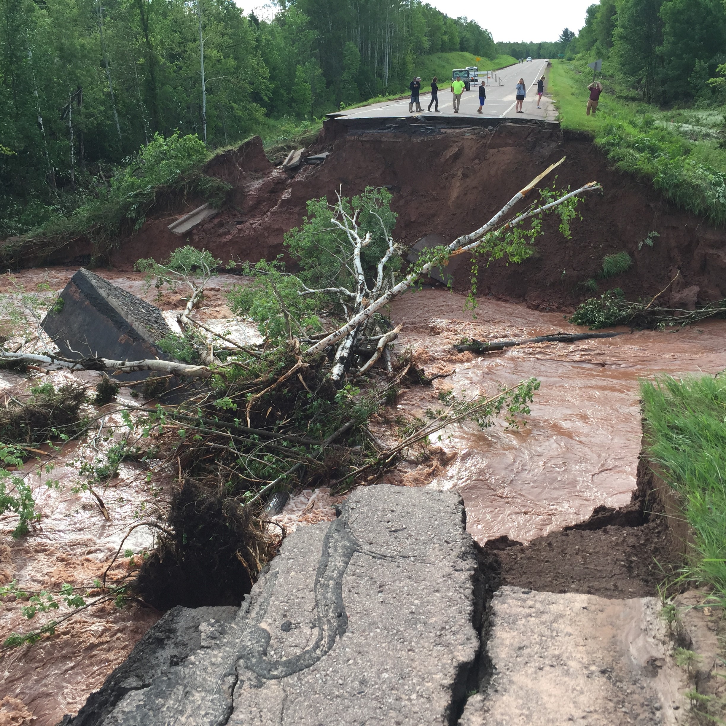
On July 11 Northern Wisconsin saw severe storms leading to millions of dollars of damage in several counties. Many roads could remain closed potentially for months greatly affecting transportation in the height of the region’s tourism season. Ayres Associates structural and highway engineers mobilized quickly to provide extremely fast-track design services to replace culverts with bridges with greater capacity to pass floodwaters. Pictured below you see an example of the damage from the storm to State Hwy 13 in Ashland County WI. Read below to see an example of geospatial technologies can to use to analyze events like these.
Ayres Survey team arrived shortly after the storm to capture several datasets from the site. One of the datasets collected was terrestrial LiDAR, a technology which can collect millions of accurate measurements quickly and efficiently. Ayres used this data to build a model of the ground surface after the flood. The results give an immediate picture of the damage to the road and the amount material the flood washed away.
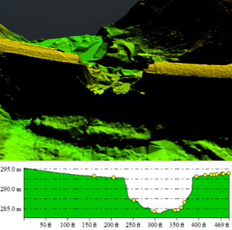
This show a profile view of the job after the July 11th flood based on the terrestrial LiDAR data
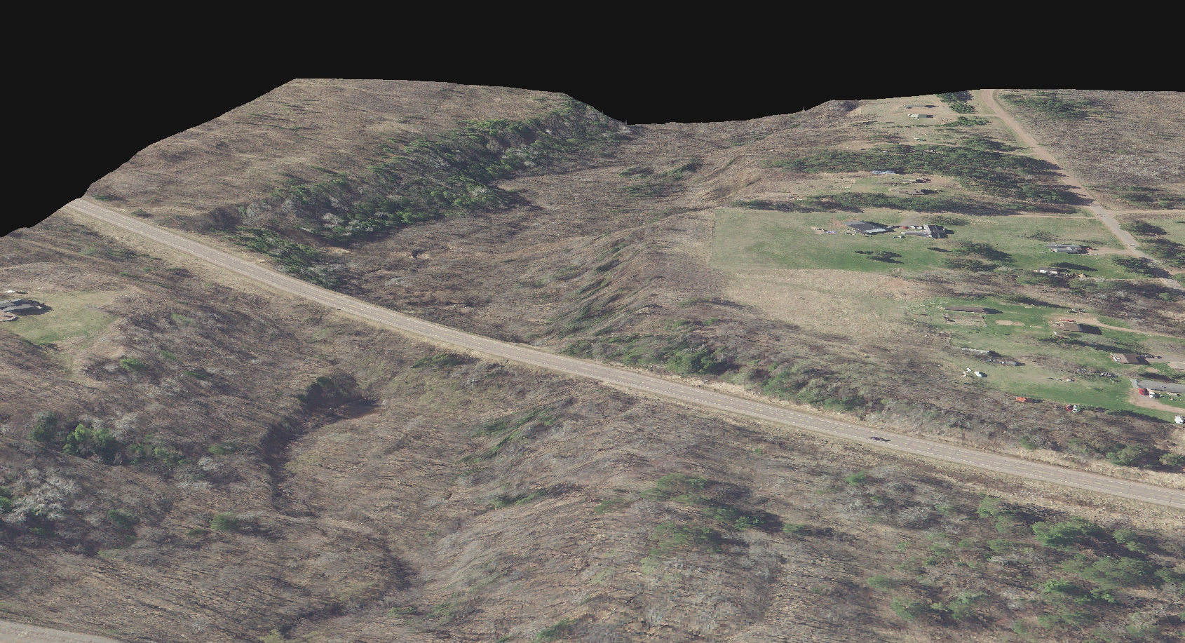
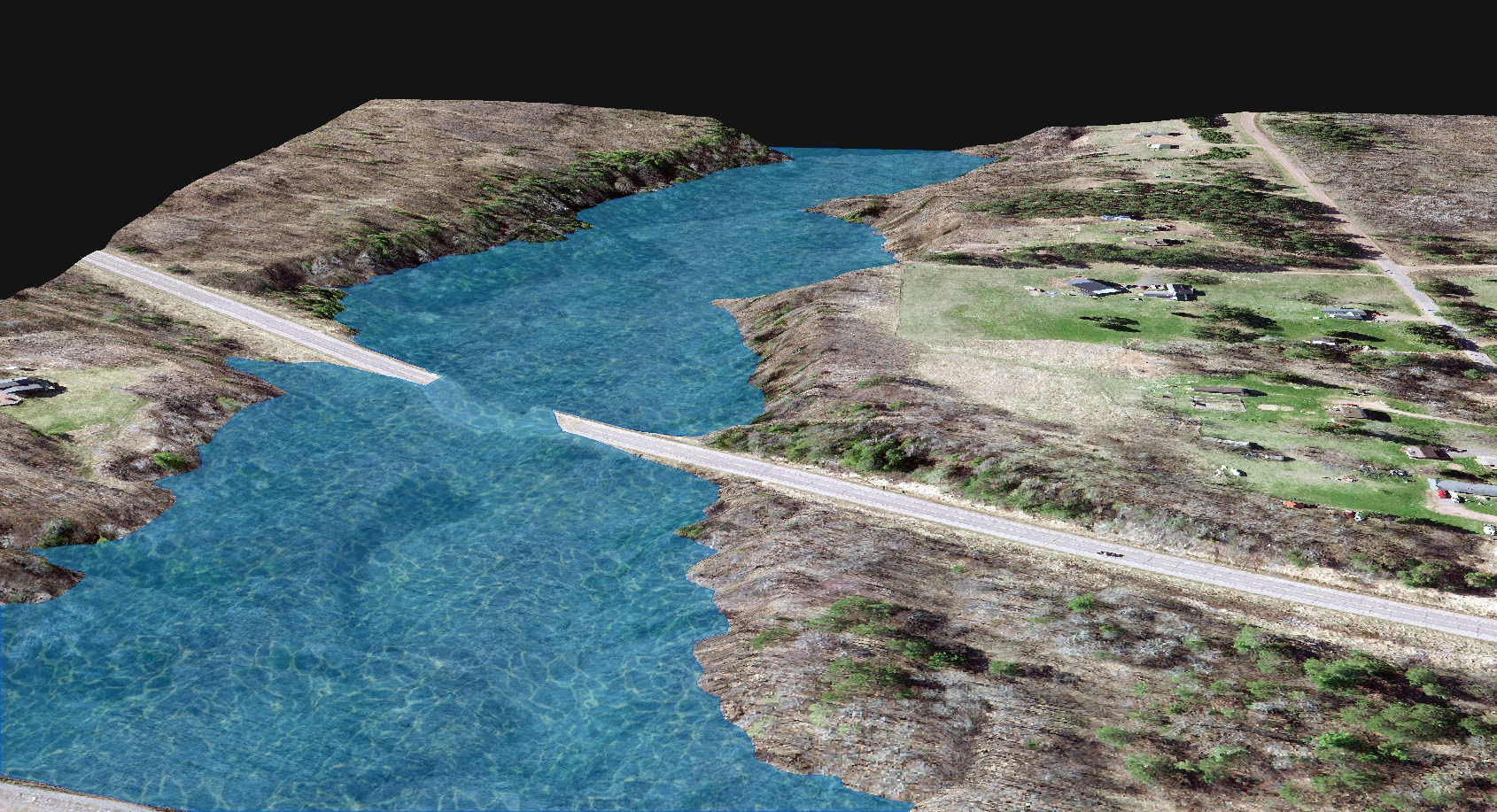
Using the 6” resolution orthoimagery Ayres produced in 2015, the County’s aerial LiDAR data, and the newly acquired Terrestrial LiDAR data our surveyors just collected Ayres Associates geospatial team wanted to look closer at this site to see what could be learned. By merging the orthoimagery with the County’s LiDAR, an image is produced which give the viewer an impression of the site prior to the July flood.
As the rain fell it would have overwhelmed the existing culverts and effectively turned the road into a dam. Modeling in the water that was being impounded behind the road prior to the road failing it may have looked like this.
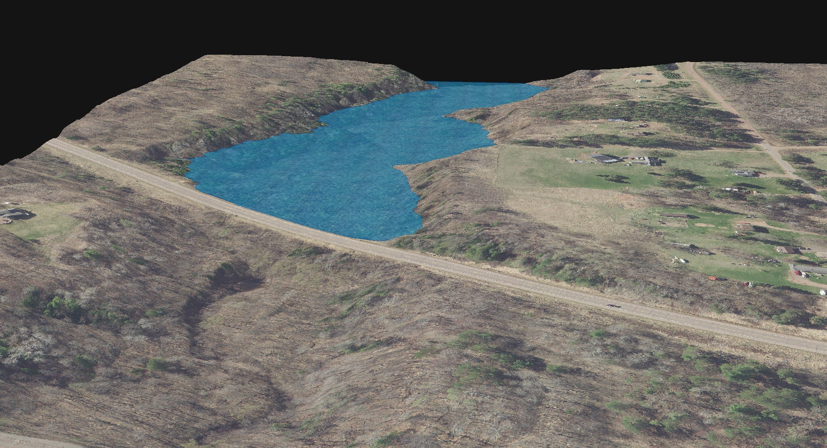
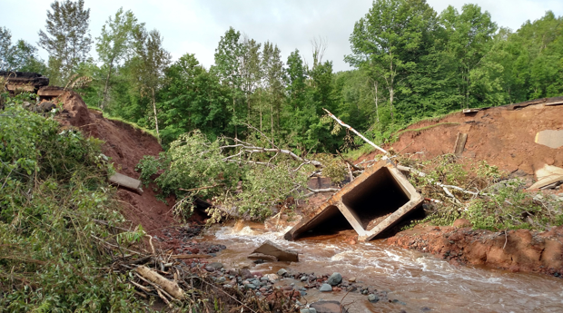
As the culvert capacity was exceeded, the road overtopped and washed out the culvert and road bed.
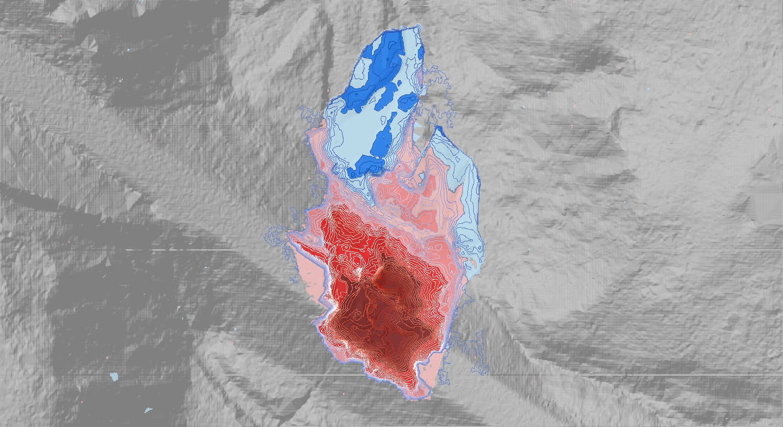
When a road washes out like this a lot of material is moved changing the landscape down stream. To measure what the change is and where it occurred Ayres technicians were able to compare the ground surface elevations from 2015 to the terrestrial LiDAR survey completed after the flood. In the map below you can see in red where material was removed and in blue, where it was deposited. In areas the change was greater than 20 feet.
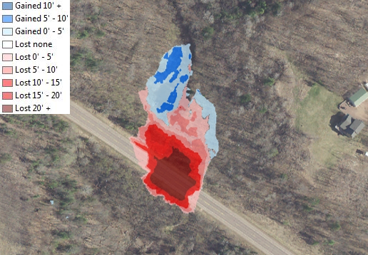
Flood events like this can dramatically change the landscape lowering elevations in some areas and raising it in others. Understanding this change is important for several reasons:
- Understand how water will flow at this site in the future
- Aid in emergency management planning
- Measure the amount of material lost
- Estimate costs for fill material to rebuild the site
- Help to engineer smarter structures for the site


3 comments
Meg Galloway
July 22, 2016 at 5:04 pm (UTC -6) Link to this comment
I enjoyed reading about the application of terrestrial LiDAR to a post disaster situation.
I am wondering if the impoundment should not be on the other side of the road in your depiction of the flood just before it overtopped the road. If all but the last two graphics/photos have essentially the same orientation, the impoundment would have been on the left side of the image.
Michael Seidel, GISP
September 7, 2016 at 8:28 am (UTC -6) Link to this comment
Hi Meg,
That is a very astute observation. As I created the graphics perhaps I can shed some light on it. The view in the graphics showing the amount of material gained or lost is oriented with North being to the top (as you’d expect). The oblique views showing the flood waters are looking towards the South which makes it appear backwards. I guess the addition of some simple north arrows could clear up that confusion. 🙂
Thanks for you comment and checking out our blog!
Ulf Gafvert
July 26, 2016 at 1:38 pm (UTC -6) Link to this comment
Adam,
Nice opportunity to show how one can make use of elevation data like this. Well done.
Fun job, no?