

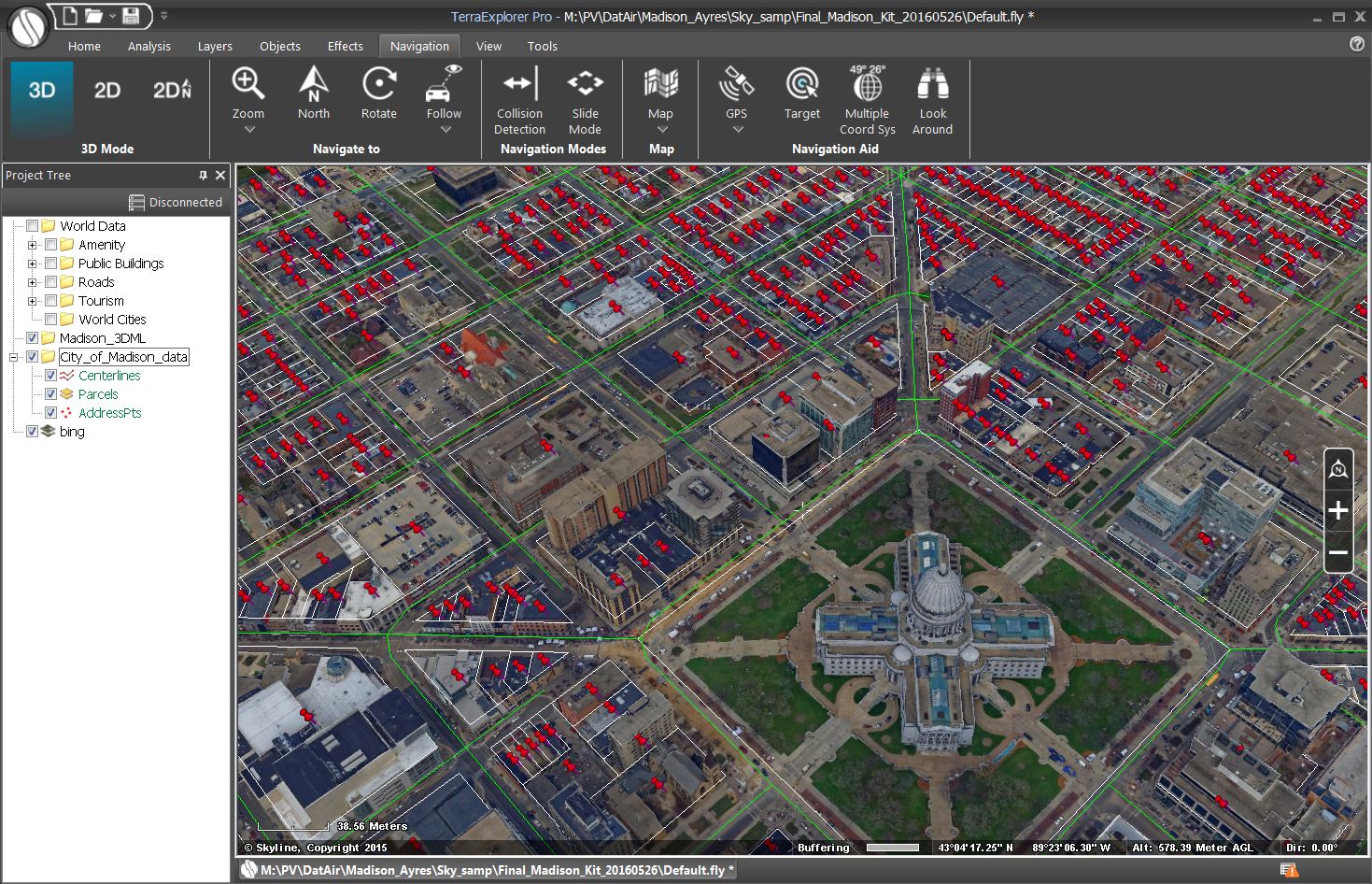
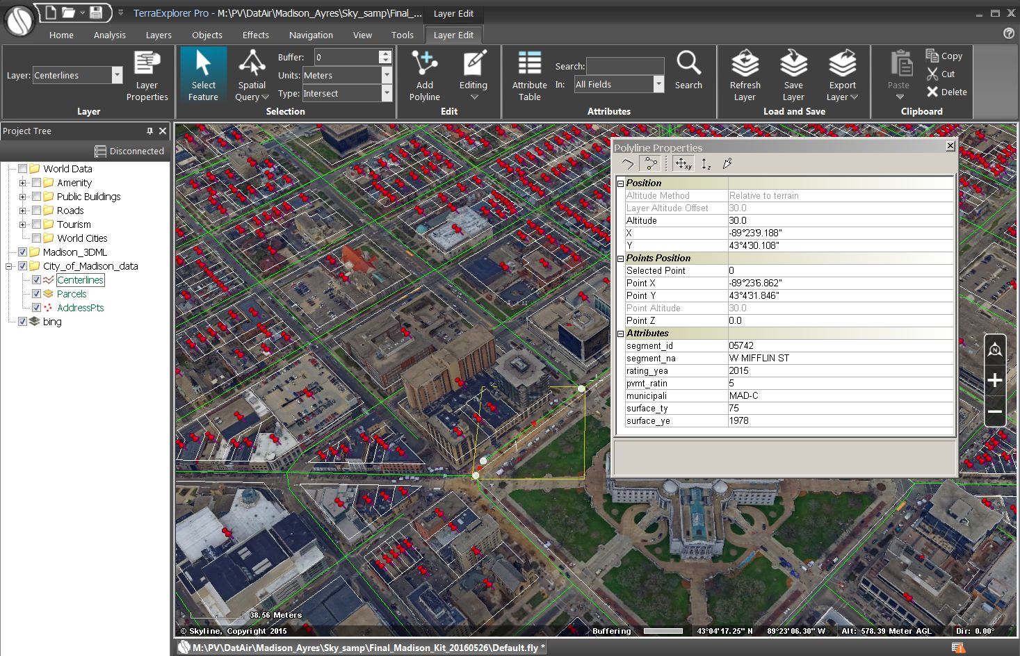
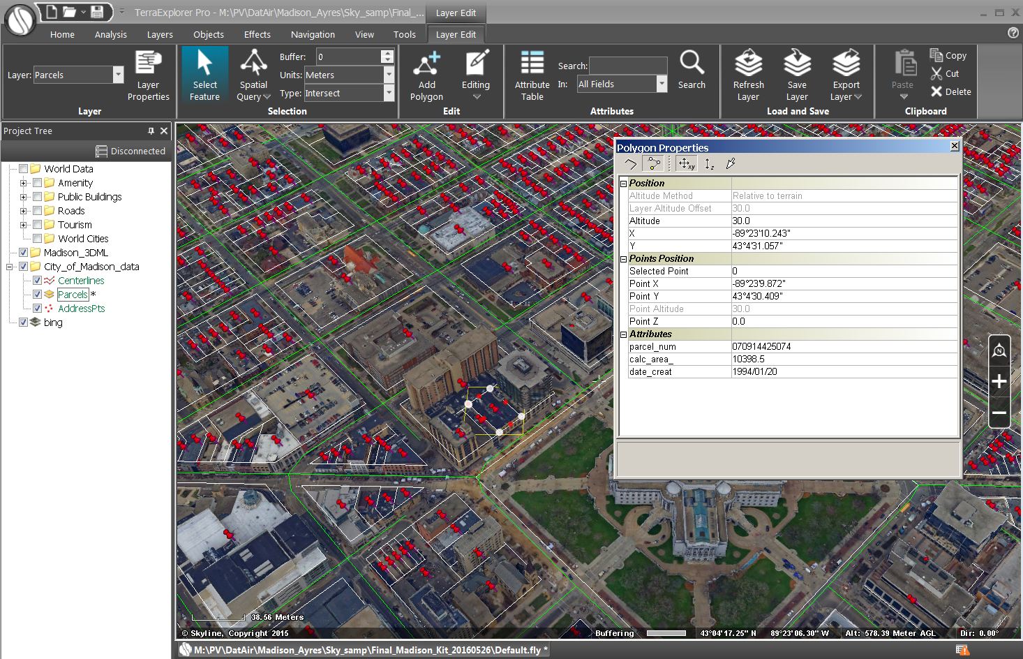
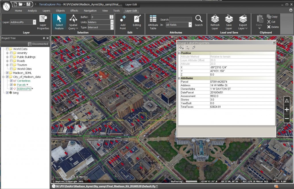
As a follow up to our earlier blog article on our new oblique solution, we are demonstrating that our 3D viewing platform will permit referencing of existing vector data. In this example, we are showing parcel data and road centerline data layers from the City of Madison draped over the 3D photo mesh model.
Please see the earlier blog article for more additional information and graphics: http://www.ayresgeospatial.com/2016/05/27/ayres-shares-new-oblique-solution-at-umgeocon-16/


Recent Comments