

Delineating and mapping building footprints may be used for multiple purposes such as emergency management, planning and zoning, demographic estimations, and natural resource management. It is fairly quick to heads-up-digitize buildings in a small area of interest. But it is very time consuming to digitize building footprints for a large area. Using classified LiDAR points to generate a polygon representing the building boundary speeds up the process of delineating buildings enormously.
It begins with classification of the LiDAR points into their respective classes. A sample of LiDAR points classified as buildings is shown in Figure 1. Bringing it into a GIS and performing a buffer on the high density points generates polygons much more efficiently than ever before. For better representation we manually review the building polygons, which can be shown in Figure 2.
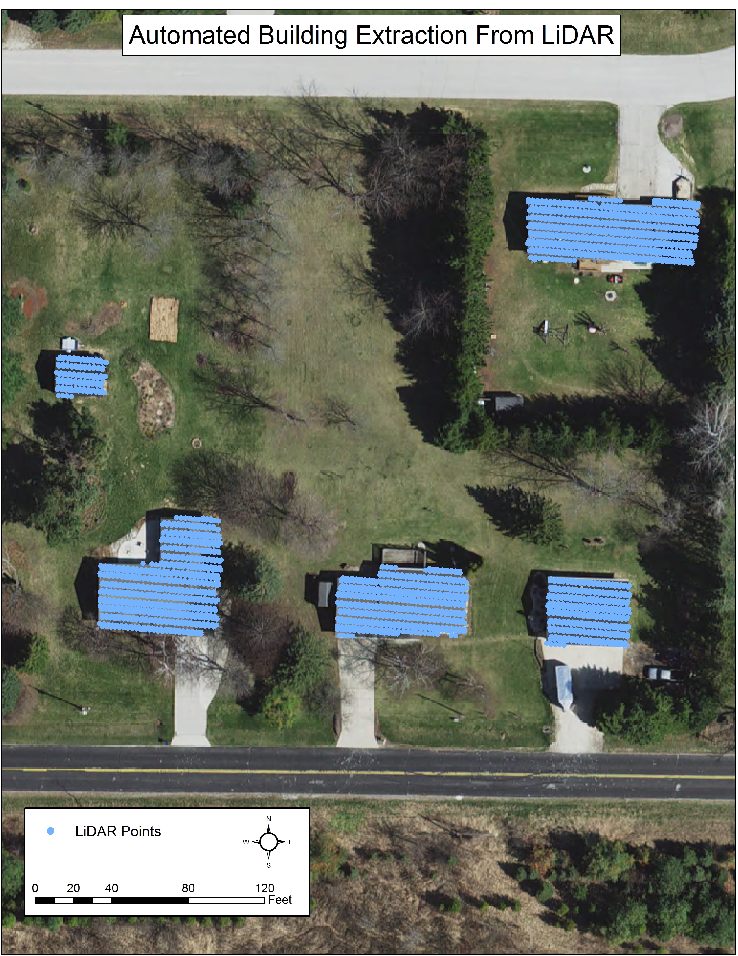
Figure 1
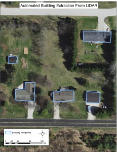
Figure 2
Examples of potential uses:
- Planning and Zoning – shoreline issues with buildings being built within the allowed distance.
- Emergency Management – to assess if buildings are at risk of floods, wildfires, crime, etc.
- Visualization
- Estimating Social and Demographic Data
Example of Shoreland Zoning Use:
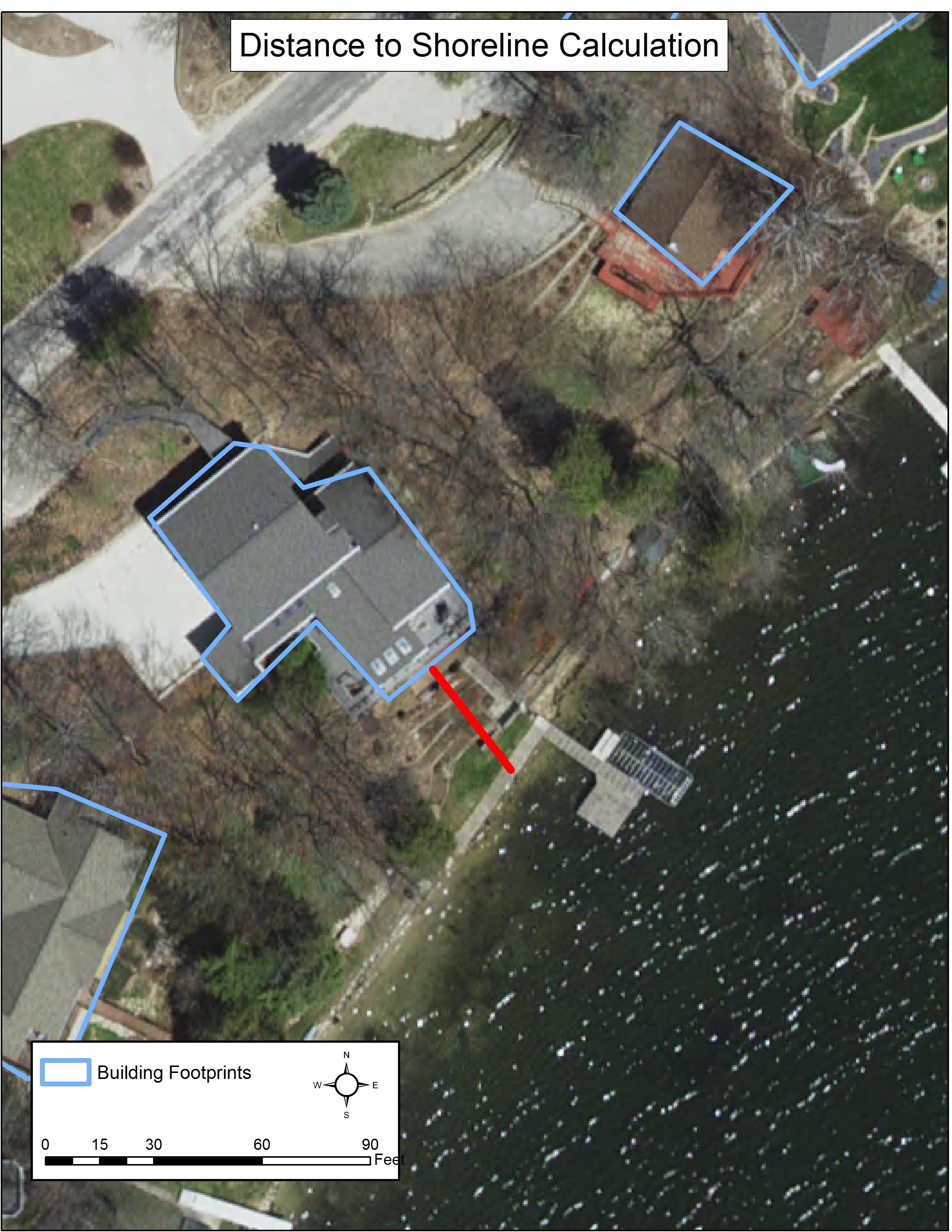
Figure 3
Wisconsin Legislature Chapter NR 115 includes information about the minimal distance that a building must be built from any navigable water. Efficiently constructed building footprints could aid in the minimum zoning standards of shorelands in Wisconsin (Figure 3).
More Examples of Building Footprints:
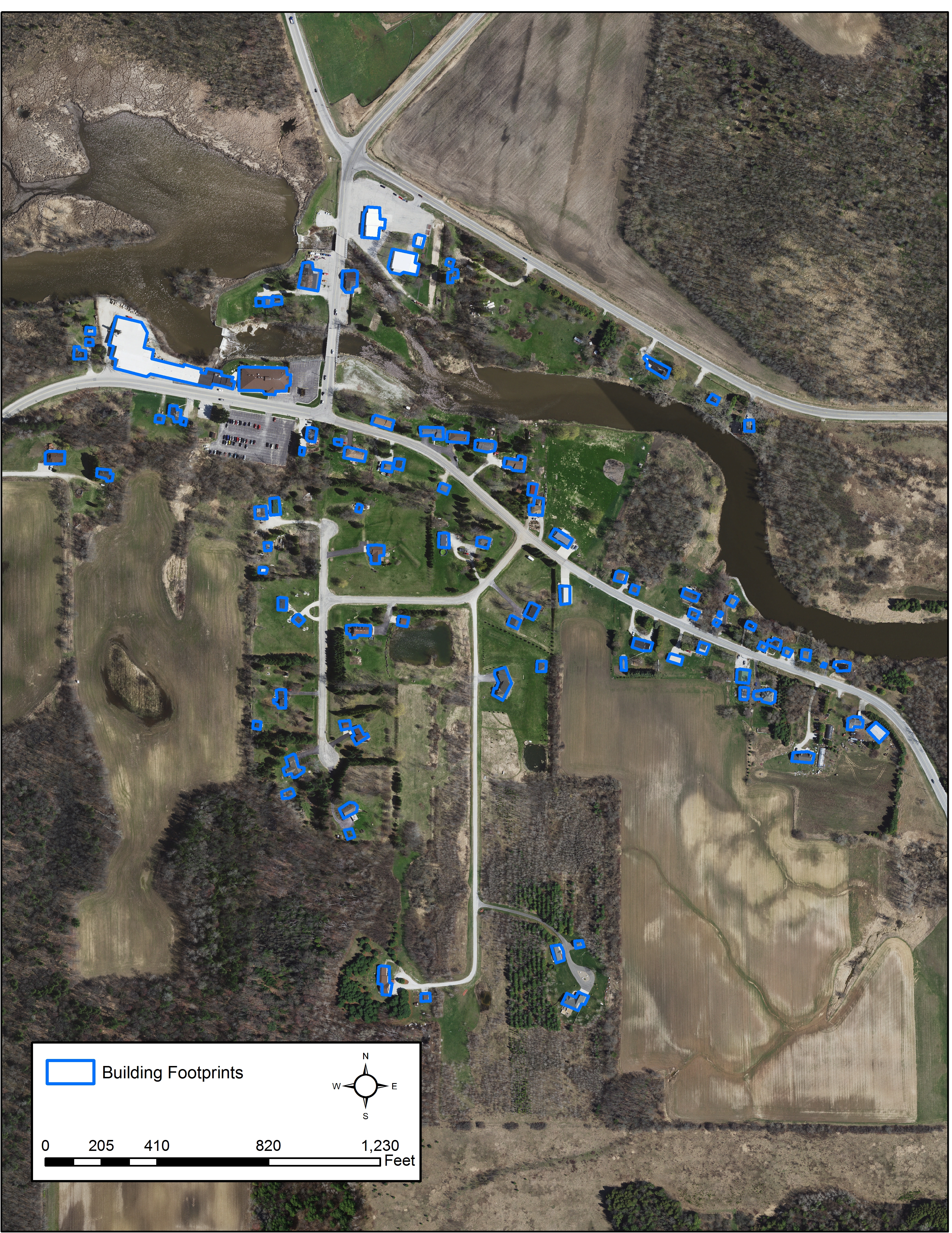
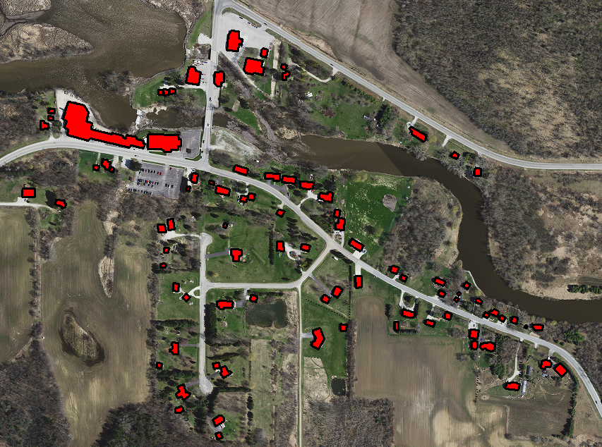
Building Footprints with Orthophoto Background
Manitowoc County, WI
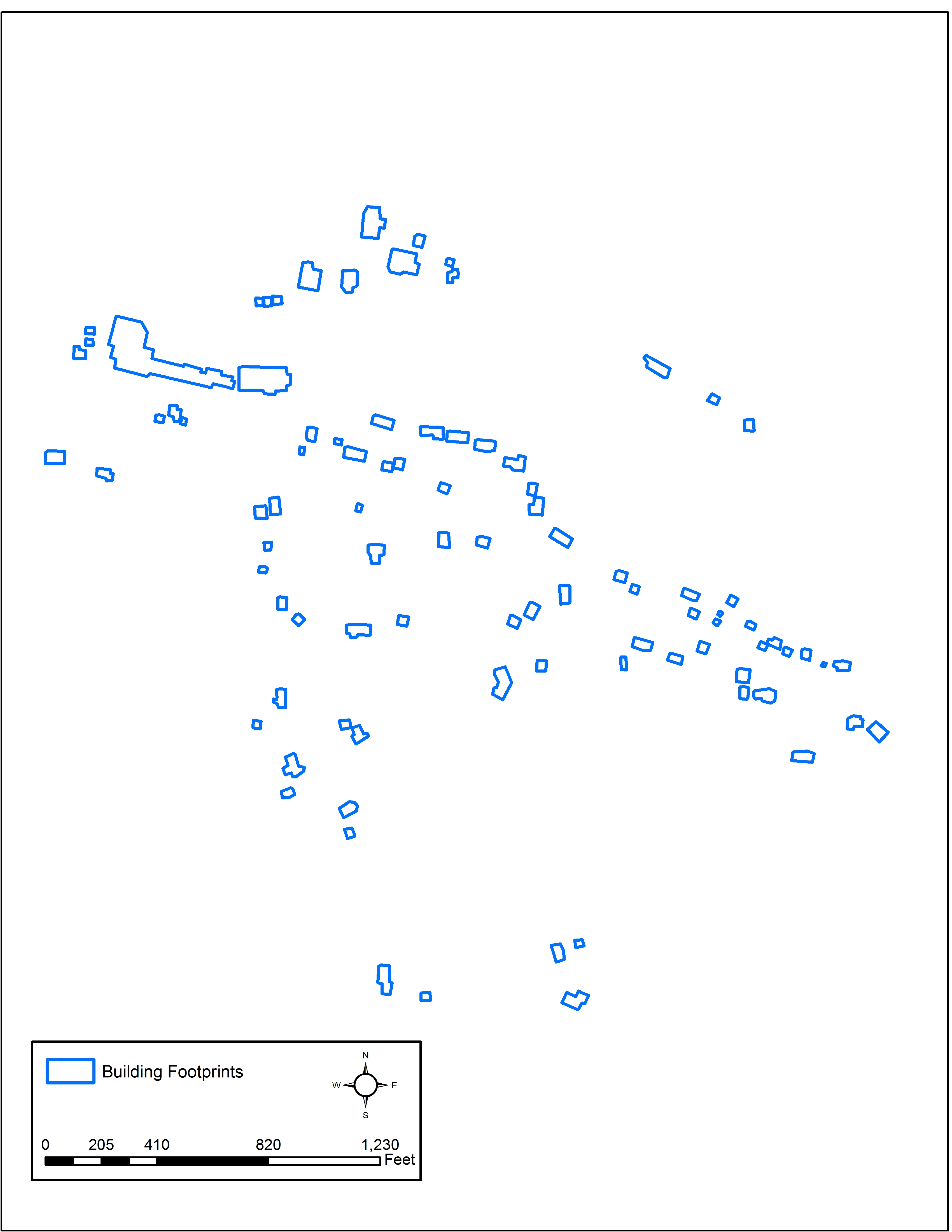
Building Footprints without Orthophoto Background
Manitowoc County, WI
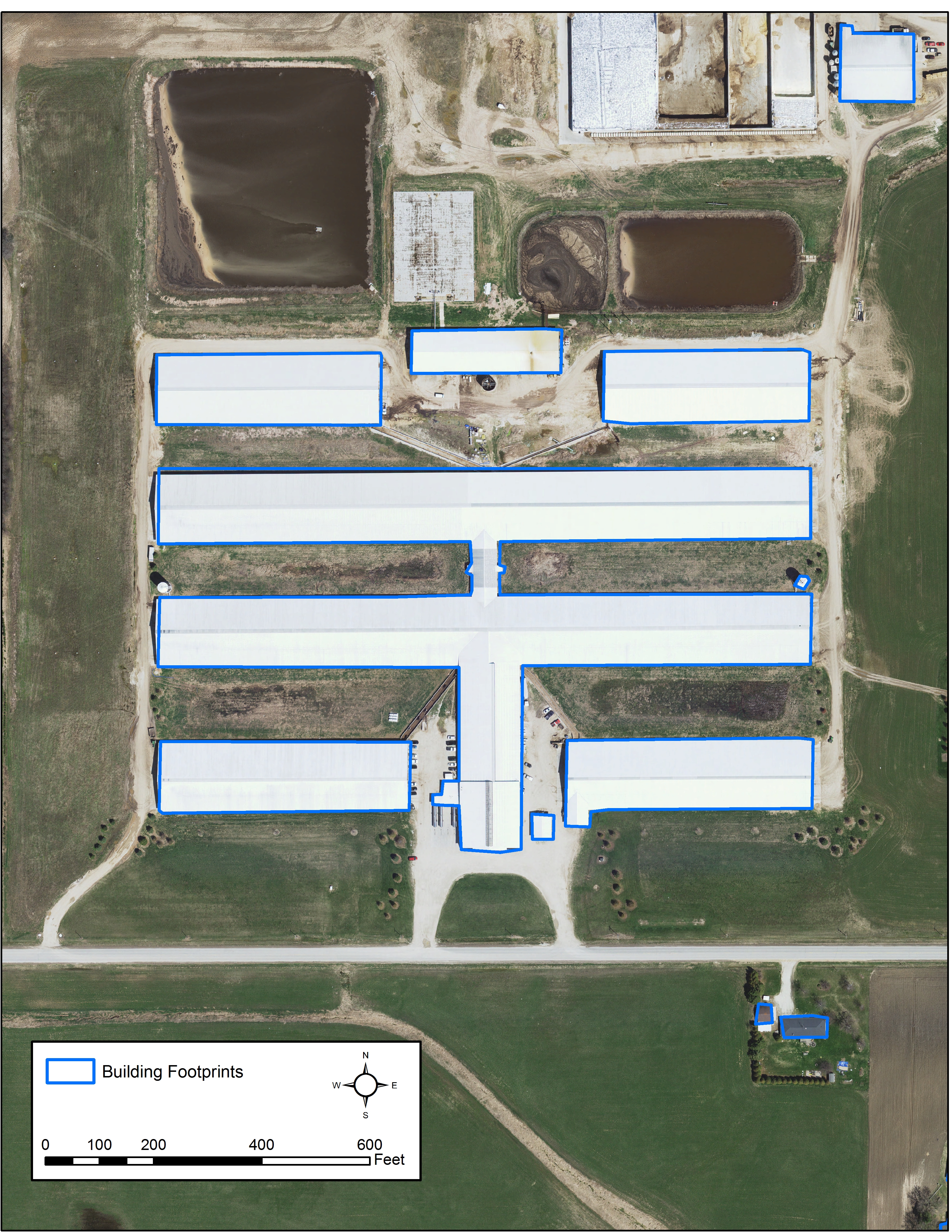
Industrial Building Footprint
Manitowoc County, WI
My name is Brandon Lee and I am currently working with Ayres Associates as a Geospatial Intern at the Madison Terrace Office. I am a student at the University of Wisconsin Stevens Point with majors in Geographic Information Science and Water Resources. Some recent research projects I have completed include modeling storm runoff for multiple watershed delineation methods and classifying stream alterations to identify land use correlation. The latter was presented at the Wisconsin AWRA State Conference this past Spring. My interests include modeling environmental and hydrologic processes in GIS, water quality, and remote sensing.


Recent Comments