

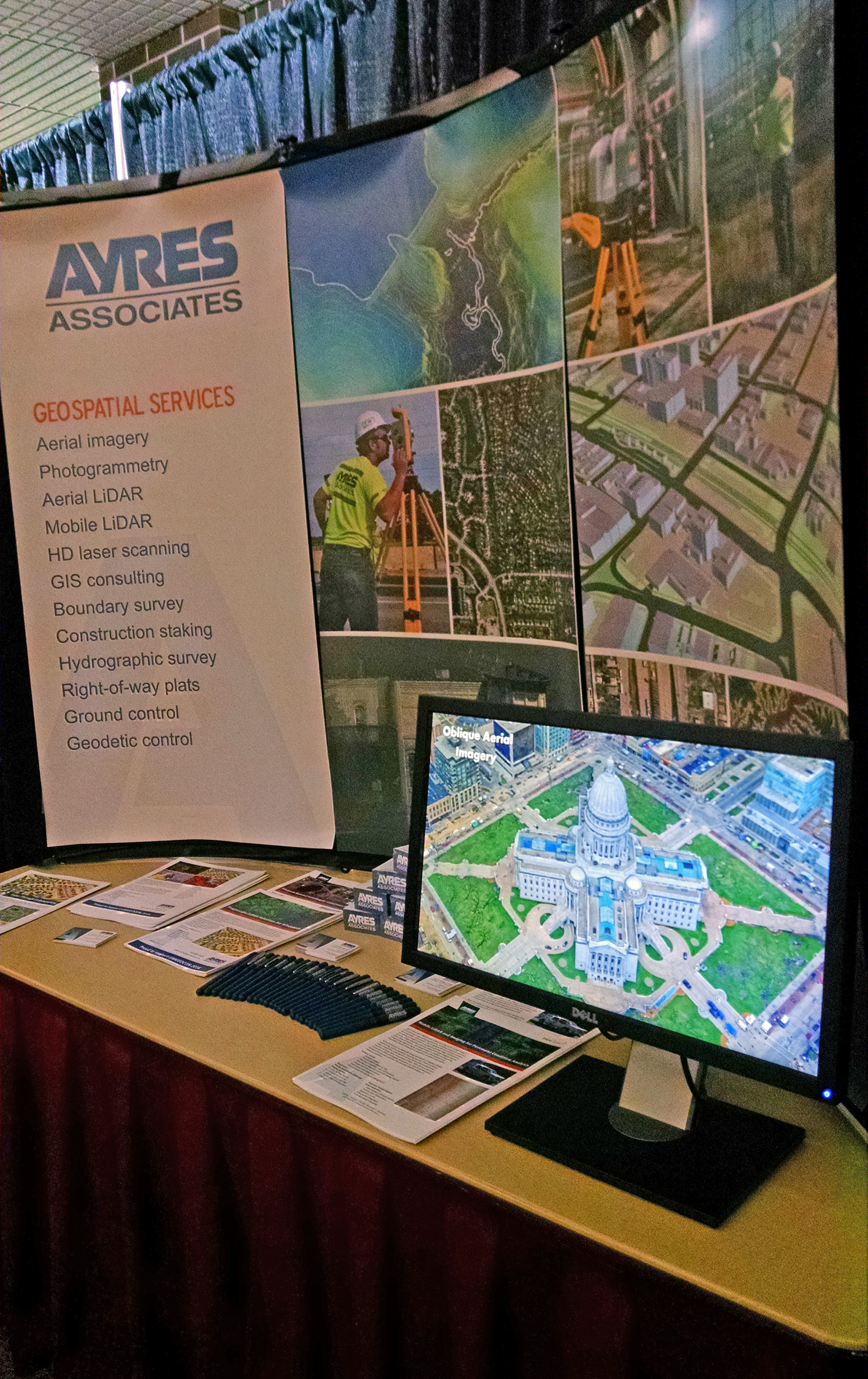
Ayres Associates is developing a new oblique imagery solution for local government and utility applications. We were excited for the opportunity to show this off at Upper Midwest GEOCON in La Crosse, Wisconsin this week.
 UMGEOCON 2016 was a first-of-a-kind gathering of geospatial professionals and users from multiple states in the region: Illinois, Iowa, Minnesota, and Wisconsin. This was a unique opportunity to see how geospatial data is being collected, used, and managed for a wide range of applications, including transportation, utilities, local government, environmental, and commercial. Ayres is proud to support this conference and appreciated the chance to show off some of our new services.
OBLIQUE IMAGERY
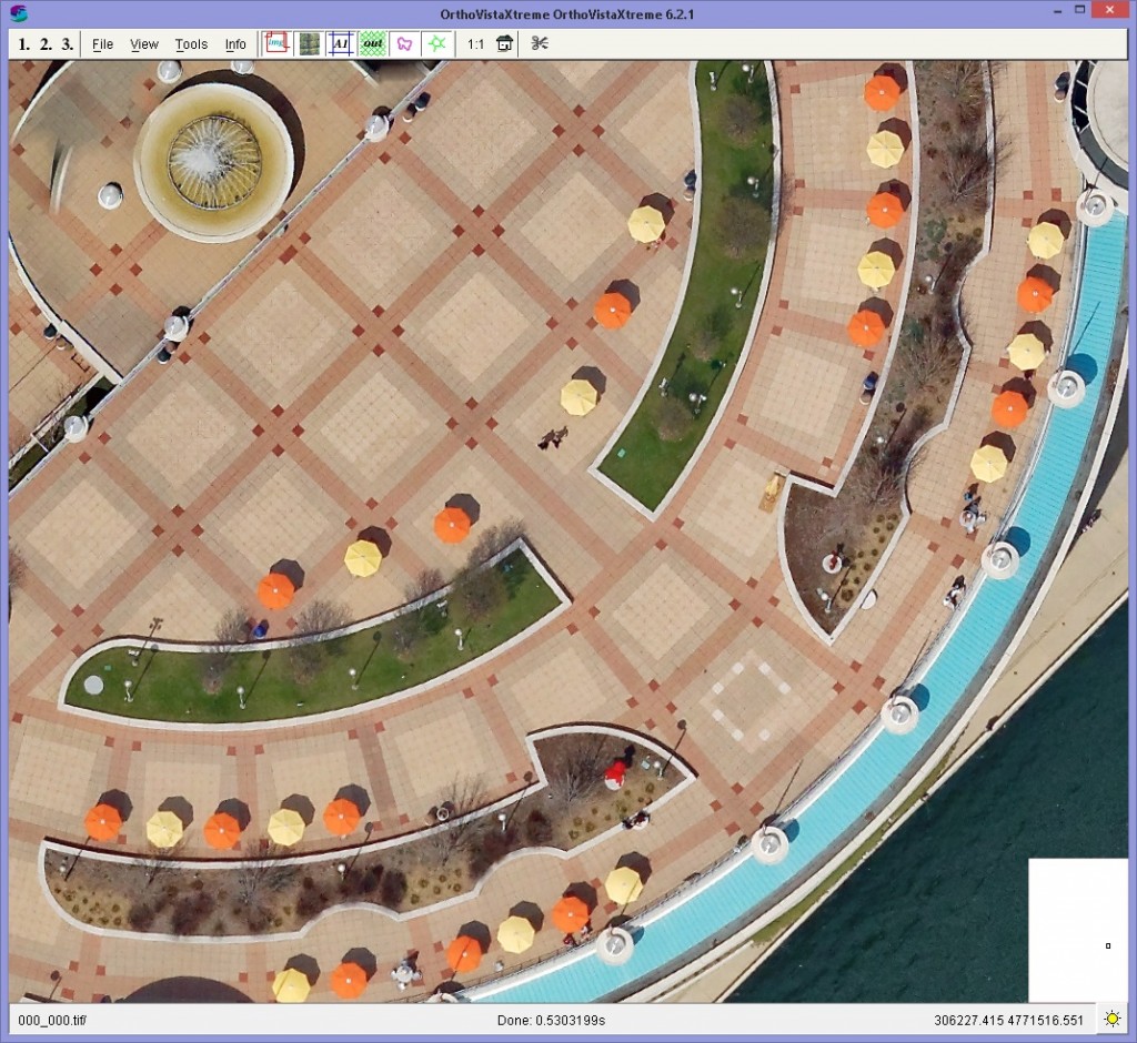
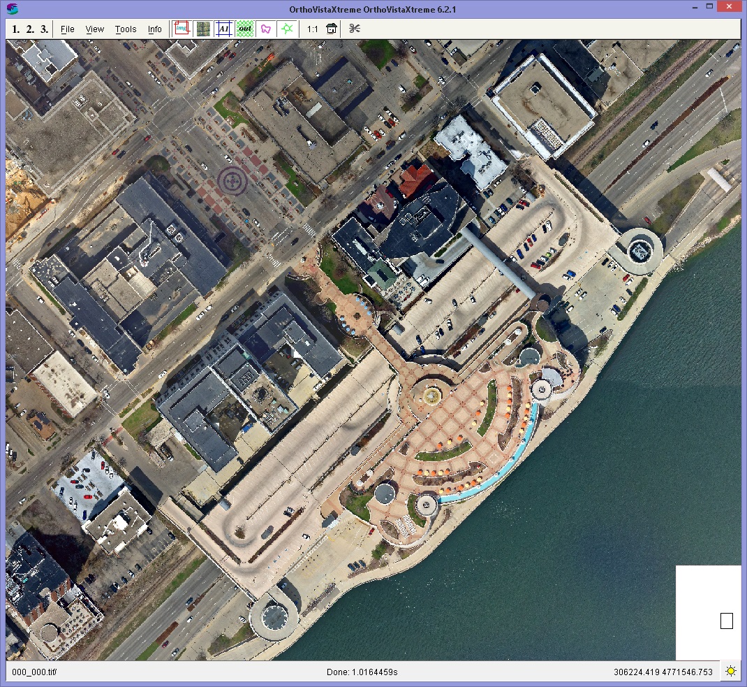
 This system employs a 9-look array of digital cameras that can effectively capture resolution up to 2-inches for large project areas. We recently completed a test over the Madison, Wisconsin area. With this approach, we are able to easily reference dozens of images that correspond to any particular point on a map- each representing a distinct look angle and perspective.
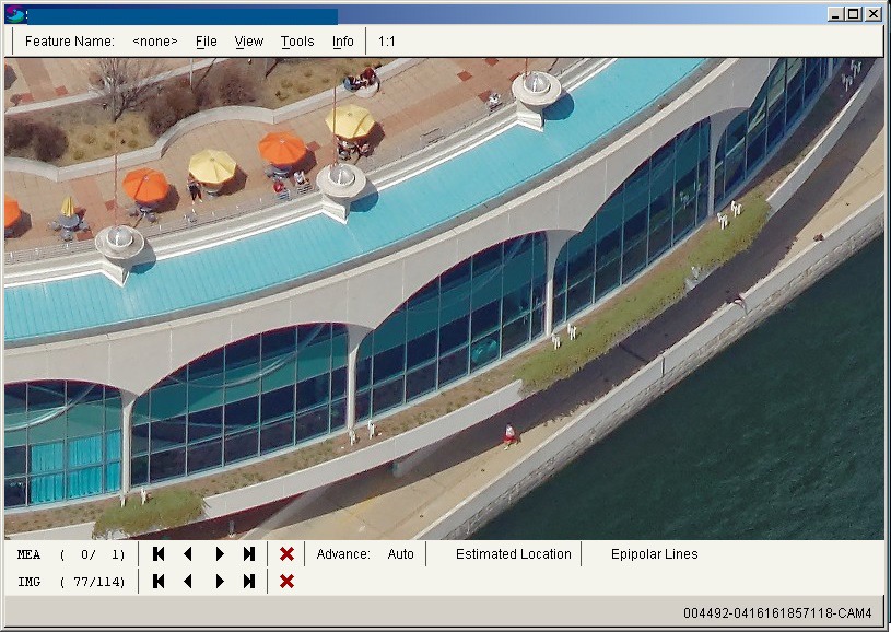
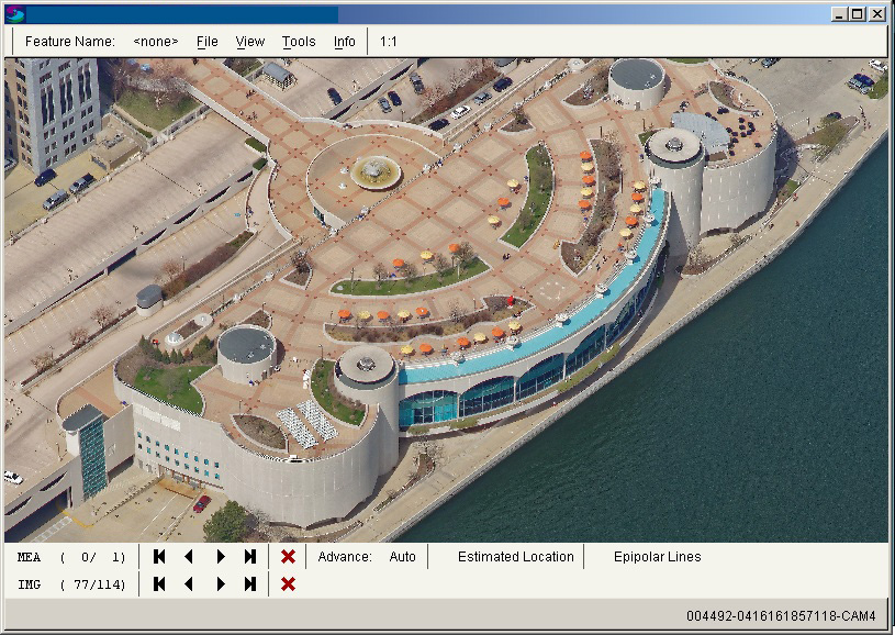
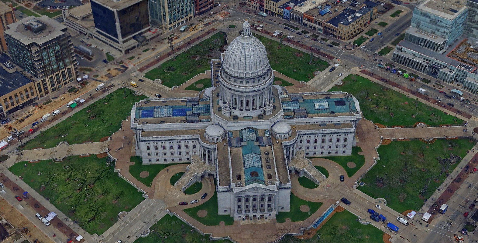
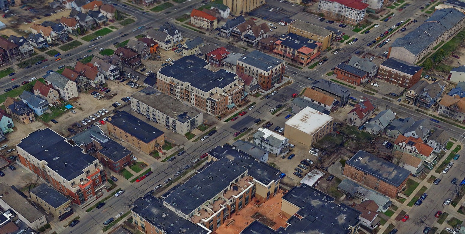
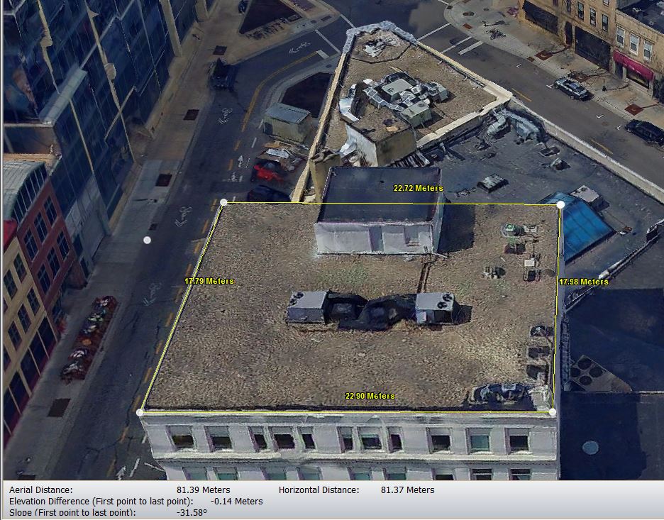
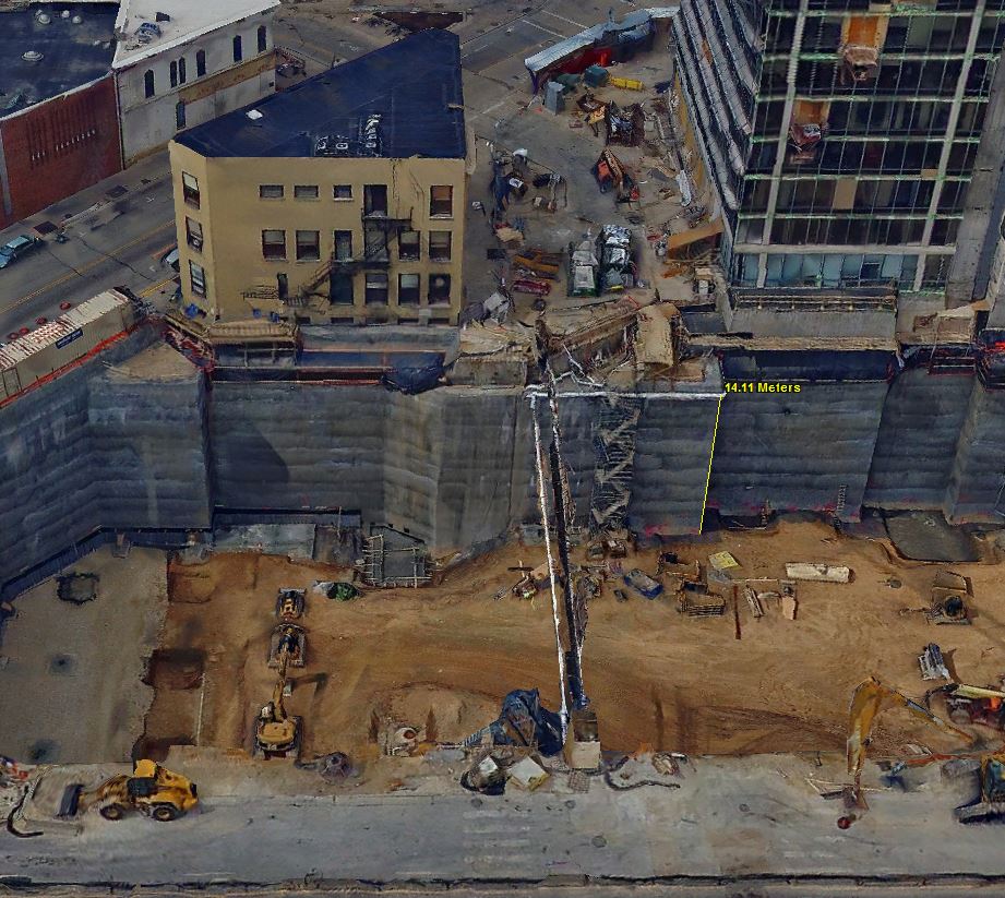
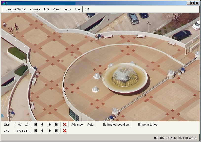 Our oblique package also includes the ability to create 3D photo mesh of an area from the imagery. This allows us to create high resolution 3D models of an urban environment with an image drape. The viewer that accompanies this product permits the import of shapefile vector data to enhance the ability to attach parcel information, 3D infrastructure, and utilities. It also allows the end user to take horizontal, vertical, and area measurements.
 Examples of applications:

-
– Situational awareness
-
– Asset management
-
– Zoning and code enforcement
-
– Urban planning
-
– Marketing/promotional material
3D PHOTO MESH AND 3D MODEL
Measurement Capabilities


1 ping
Ayres Oblique 3D Viewer Incorporates Municipal GIS Layers » Borders & Frontiers
July 15, 2016 at 9:18 am (UTC -6) Link to this comment
[…] Please see the earlier blog article for more additional information and graphics: http://www.ayresgeospatial.com/2016/05/27/ayres-shares-new-oblique-solution-at-umgeocon-16/ […]