

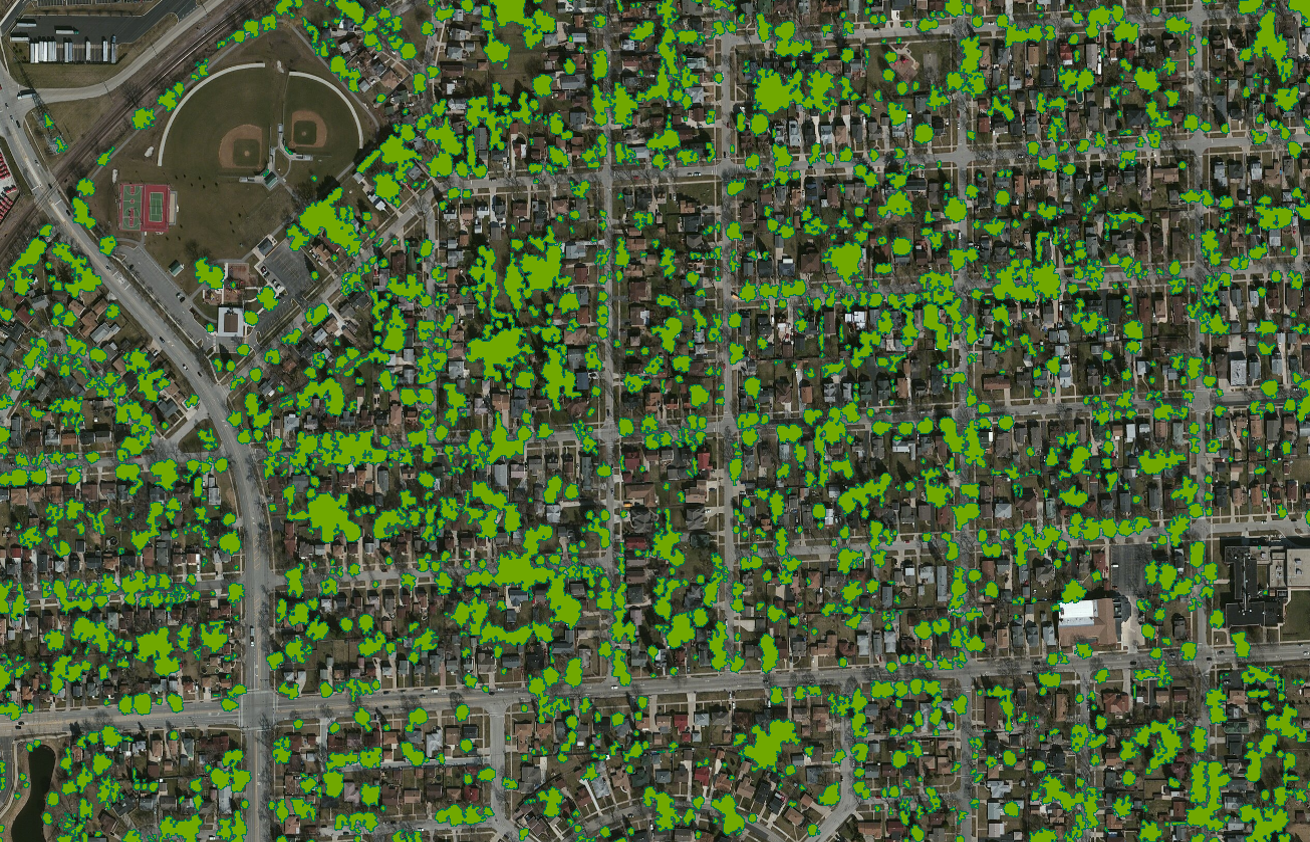
Recent developments in mapping technology have made it possible to efficiently extract two dimensional tree canopy polygons from LiDAR point clouds, even in leaf-off conditions.
Historically, LiDAR data has been utilized primarily to create high resolution ground surfaces and digital contours. Digital Elevation Models and Digital Surface Models are the most common products derived from LiDAR data, but there is much more information that remains locked inside of the point cloud thanks to its multiple-return nature. This information includes any elements found at or near the ground such as: buildings, vehicles, power lines, and vegetation.
The process of tree canopy extraction begins with a classified point cloud – specifically: ground, high vegetation, and building classes. The better this classification is the more accurate the canopy representation will become, although it is not essential that everything in the high vegetation class is actual vegetation. Things like power lines, light poles, basketball hoops, and even rooftop points can get lumped into the high vegetation class due to the automated nature of point cloud processing, and that is where canopy modelling takes over.


Left: High vegetation points showing inclusions such as roof lines, and power lines. Right: Tree canopy polygons overlaid on high vegetation points
Point clouds are robust and even small areas will contain millions of points classified as high vegetation. These points are extracted from LiDAR processing software and brought into a GIS where it is aggregated to create polygons, filtered, and smoothed to create accurate representations of the real world tree canopy from above. The results can be further refined to only accept trees above a certain size or trees that meet certain geometric characteristics.
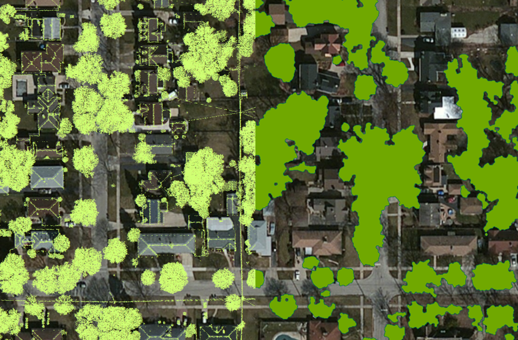
Side-by-side comparison showing high vegetation points on the left and tree canopy polygons on the right
At Ayres we are continually looking for methods to extract secondary information from point cloud data that adds additional value to the product at reasonable costs. Tree canopy polygons are one such product that can be obtained quickly and accurately from the data you may already have.
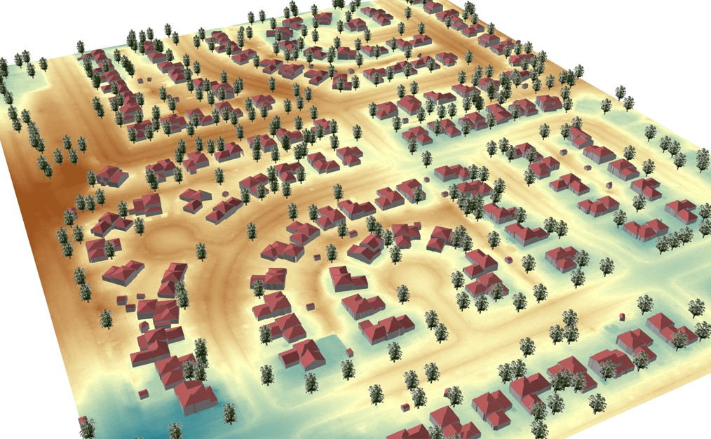
Further analysis showing canopy polygon centroids rendered in a 3D environment with realistic looking trees


1 comment
Jorge Andrew Cipriano
December 2, 2016 at 7:09 pm (UTC -6) Link to this comment
Hello Sir,
Can you share your knowledge about the method you used in this study? I’am very interested with your study sir. This can help urban planning in our town. I’am from philippines by the way.
Thank you,
Hoping your kind consideration.
Your’s,
Jorge