Spring Aerial Photography Season is Here!
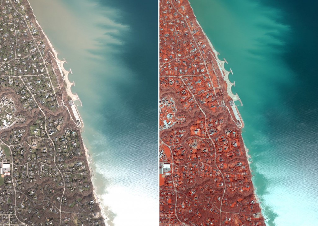
The Aerial Mapping group at Ayres Associates has officially kicked off their spring aerial photography season for 2016. The flight crews will be busy traveling throughout the Midwest over the next couple of months capturing high resolution aerial imagery. Take advantage of the opportunity to capture cost effective imagery for your projects while the aircraft and digital mapping camera are crisscrossing the region.
Ayres Associates will be acquiring thousands of frame of aerial imagery using their Leica RCD30 digital camera. The imagery captured will support a wide range of engineering, survey, and environmental applications across the Midwest.
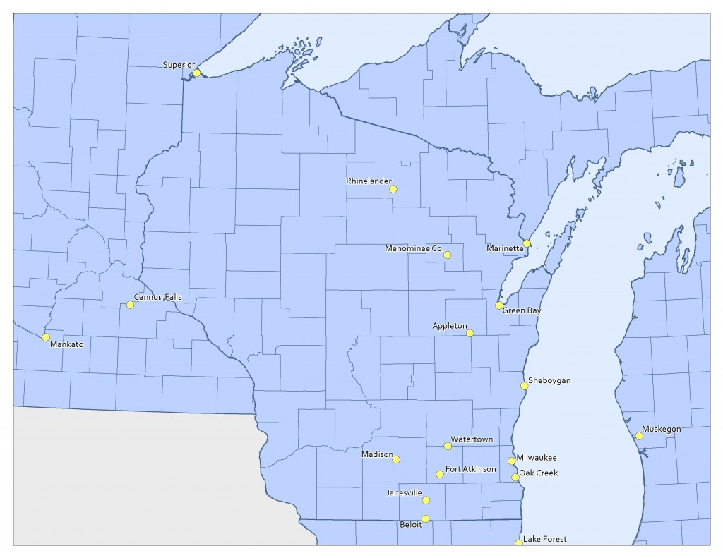
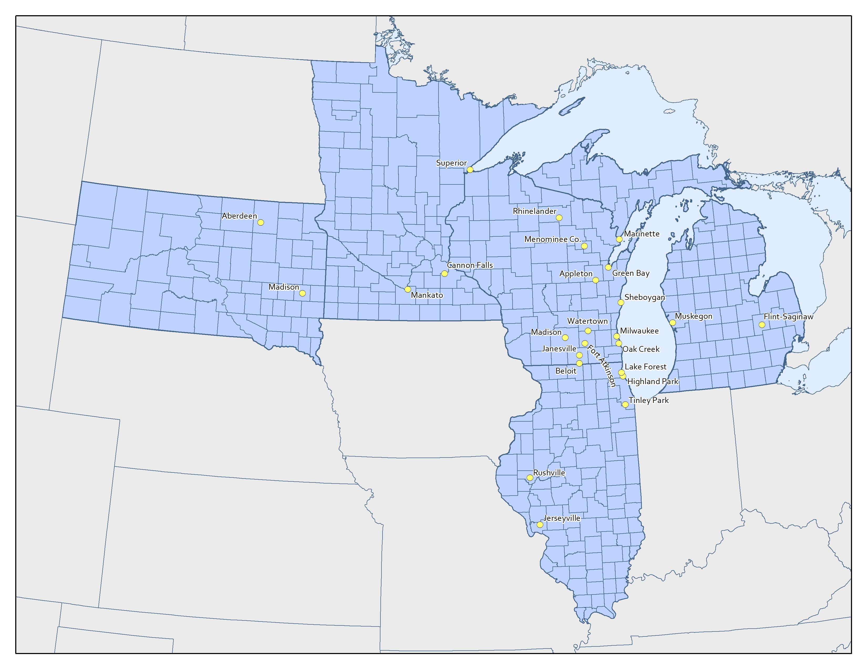
Project locations are shown in the maps below:

Examples of projects using this high resolution imagery:
-
Transmission line rebuilds in South Dakota
-
Pipeline corridor in Michigan
-
Ecological management in Green Bay and Lake Michigan (Phragmites)
-
Transportation design in Minnesota
-
Forestry in Oneida County, Wisconsin
-
Municipal engineering in Chicago region
The first missions to be completed are located in central Illinois for county and municipal projects. The crew will be making their way north over the coming weeks covering a substantial amount of territory from South Dakota to Michigan. Contact us now to discuss aerial imagery options for your project.


Recent Comments