

Complex real world problems require multifaceted solutions, and Ayres Associates stepped to the plate and delivered during the 2016 holiday season. Under tight time constraints and adverse weather conditions, the staff from our Aerial Mapping and Land Survey groups combined forces to fulfill an important year-end delivery. The result was accurate data put into the capable hands of the client for making important and timely decisions to move a project forward.
Efforts began with mobile LiDAR data collection, GPS ground-based survey, and airborne acquisition of high-resolution aerial photography. The mobile LiDAR was collected over the course of a week in late November, while the GPS survey data collection began around the same time and continued throughout the Christmas season. The aerial imagery was acquired in late November just before the first snowfall. Processing of the spatial data began immediately upon completion, with the GPS survey data being tackled in chunks as it became available.
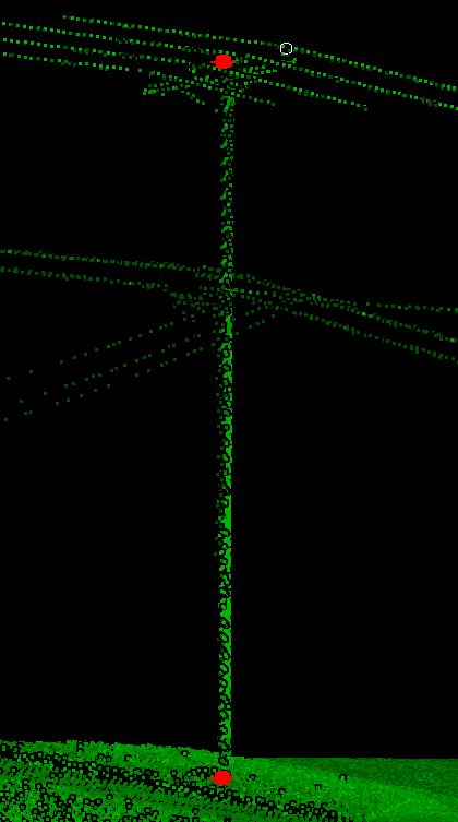
The mobile LiDAR data was brought into 3D point cloud processing software where skilled technicians extracted points of attachment on distribution poles. This was a big undertaking which resulted in the extraction of more than 10,000 such points throughout the dense suburban project area.
Using high accuracy GPS receivers and laser range-finding technology, the survey crews were able to obtain pole locations, pole attributes, pedestals, and georeferenced images. Survey crews also collected geospatial data of aerial attachments for final distribution. Like the mobile LiDAR, data collection and extraction were significant tasks with more than 11,000 such locations collected.
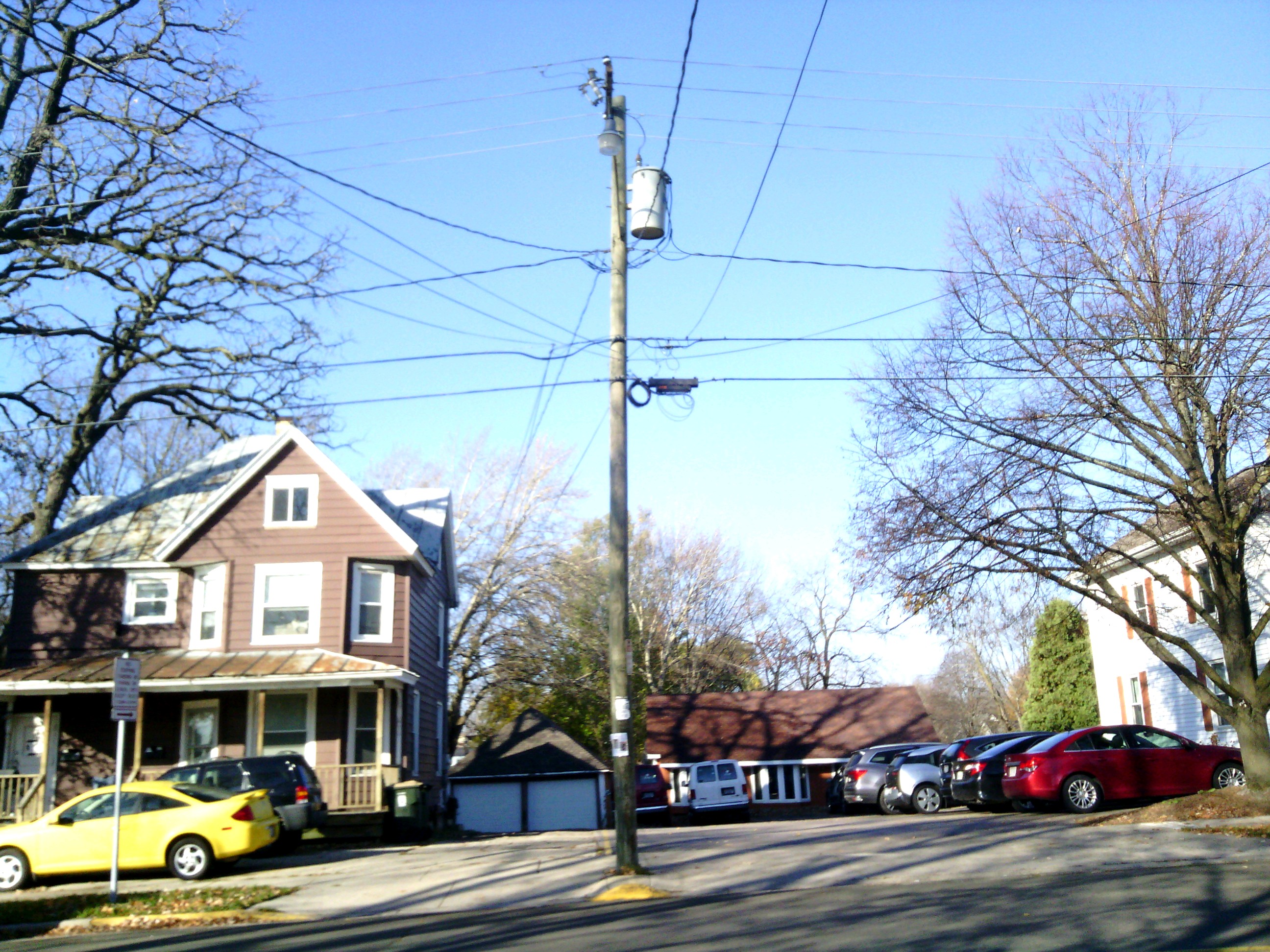
Left: Image of Pole Collected by Surveyors in the Field
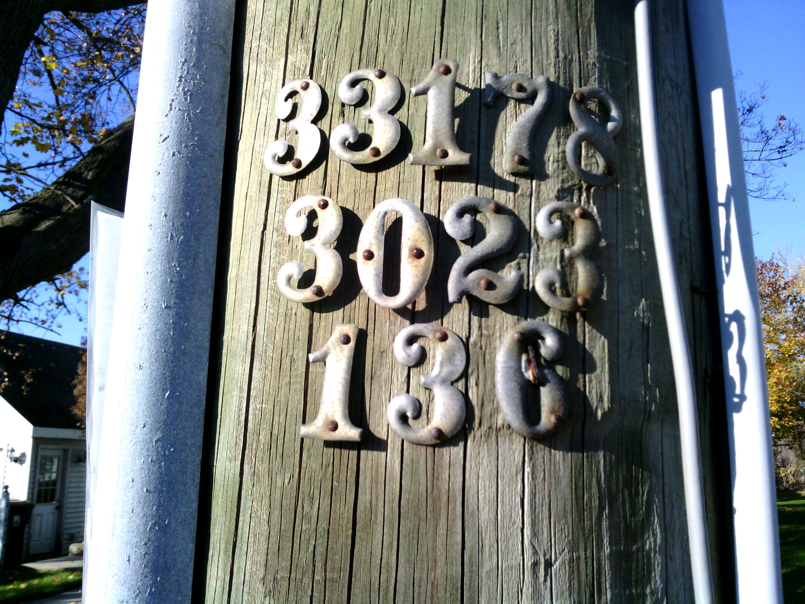
Right: Image of Accompanying Pole Tag Collected by Surveyors in the Field
The aerial imagery was used to create high resolution orthoimagery for base mapping and for 3D modeling of buildings, roads, pole tops and bottoms, and strand wires between poles. Nearly 15,000 building footprints were extracted from the stereo imagery and over 230 miles of pavement.
The final phase of the project was to bring this large amount of data into GIS in order to create a relational geodatabase…which was no small feat considering the number of data sources. Conglomerating data from multiple sources required a diverse approach involving synergizing everything under a common framework and sharing attributes among multiple themes. Text files from the GPS units were converted into spatial formats, 3D CAD files from the point cloud extraction were incorporated on a layer-by-layer basis, as were the 3D CAD files provided from stereo-compilation. Since the data was acquired from multiple different platforms, careful QC was essential to ensure the correct attributes were attached to the features they represented. This required diligent analysis and creation of a standardized processing methodology that was consistent and repeatable.
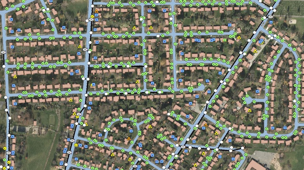
Snipet from the Final Project Map
In the end the final database was comprised of several layers of data, relational tables, and classes that define the relationships amongst them. All the data was delivered as 3D enabled layers, meaning the end user could visualize real-world scenarios, in addition to running traditional network analyses. The pole locations included hyperlinks to images of pole tops and tags. Additional attributes related to each pole contained the number of attachments and the height of each attachment above the ground surface.
All in all, this was a challenging and rewarding project for our team. Success relied on bringing together many of our specialties to produce an accurate deliverable on a tight schedule. Most importantly, the client obtained the geospatial data needed to make efficient business decisions to improve real world results.


1 ping
Ayres Expands Asset Management Offerings » Borders & Frontiers
June 20, 2017 at 11:40 am (UTC -5) Link to this comment
[…] new to Ayres Associates. In fact, we have been mapping assets for decades, and just completed a city-wide utility infrastructure project for a private client within the past year. In short, Ayres knows assets, but a recent partnership […]