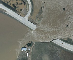
Leica Geosystems publishes article about aerial imagery collected during the historic Colorado floods in 2013
http://www.leica-geosystems.us/en/Flooding_pdf_v3.pdf
 The article does a great job of highlighting the efforts of the professionals on the user end. The engineers, floodplain and stormwater managers, surveyors, emergency responders, GIS specialists, and others deserve a great deal of thanks for their hard work during and after this catastrophic event.


Recent Comments