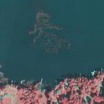
Monitor and Measure Your Aquatic Vegetation with the Latest Mapping Technology Monitoring the conditions of riparian areas is an integral part of protecting the health of aquatic ecosystems. Together with Applied Ecological Services (AES), our team at Ayres Associates has developed a method for mapping lakes and riparian zones from the air. Our partnership provides …
Monthly Archive: March 2014
Mar 28
The GIS Consortium – a role model for municipal cooperation
The Illinois-based GIS Consortium (GISC) is a group of 23 communities in the Chicago region that work together to develop GIS solutions to support a wide range of applications including municipal engineering, planning, forestry, and public safety. Ayres Associates has been providing high-accuracy mapping and surveying services to member communities since the 1980s. …
Mar 27
Emergency Response Aerial Imagery
Springtime and quick-response scenarios go hand-in-hand. Are you prepared? Ayres Associates can provide on-call aerial imagery services for your springtime infrastructure needs. This valuable imagery can help you effectively perform a range of crucial tasks: Accurately assess flood damage Analyze and evaluate stormwater efforts Prepare wisely for future flood vents using historical data in …
Mar 26
Congrats, Adam! WLIA President Elect
Adam Derringer, a Project Manager in the Geospatial Division of Ayres Associates was recently elected as President Elect of the Wisconsin Land Information Association (WLIA). Adam has served on the Board of Directors for WLIA as well as on multiple committees for many years. Adam explains, “It is a true honor and an even …
Mar 20
Mapping Transmission and Distribution Lines with Fixed-wing Lidar Systems
Ayres Associates is mapping transmission lines in the Rocky Mountains of Colorado through the use of fixed-wing Lidar systems. Poles, conductors, and utility structures are being extracted from high density Lidar point clouds and modeled as vectors in a geodatabase. Much of the focus on as-built transmission surveys over the past few years has been …
Mar 05
Feature Extraction from Aerial LiDAR
Last post I touched on how you can get more from your aerial LiDAR data – beyond contours and surface models. For more information on the topic, revisit my presentation from the 2014 Wisconsin Land Information Association Conference. Topics covered include feature extraction for buildings and vegetation, in addition to electric transmission and distribution applications. …
Mar 05
3D Building Extraction from Aerial LiDAR
Get more information from your aerial LiDAR – beyond contours and surface models. Recent advances in LiDAR systems and software are leading to new tools for extracting valuable information from point clouds. High-density point clouds can be used to extract 3D building shapefile polygons using customized algorithms inTerrasolid’s TerraModeler software. Complex 3D building models are …
Recent Comments