Category Archive: Imagery

Sep 05

Aerial Photography Supports Ayres Survey & Municipal Projects

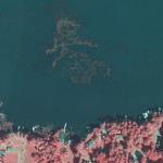
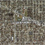
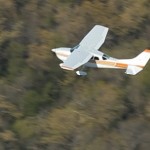
Ayres’ RCD30 digital camera provides surveyors with the ability to economically and quickly acquire aerial photography to support field operations. The Land Survey and Green Bay Municipal engineering groups of Ayres Associates are working with the Village of Denmark, WI (10 miles from Green Bay) in an effort to develop an industrial park on the west side of Interstate …

Continue reading »

Jul 02

Aerial Imagery Captures Recent History of Flooding in Greeley, CO

Flood events in Colorado in 2013 and 2014 have been recorded using aerial imagery- providing the City of Greeley with a valuable tool for assessing flood extent and for analyzing storm water infrastructure and improvements.   In September of 2013, Ayres Associates collected aerial imagery of the South Platte River and its tributaries near peak flood stage, …

Continue reading »

May 01

Ayres Associates Featured in Leica Article on Colorado Floods

Leica Geosystems publishes article about aerial imagery collected during the historic Colorado floods in 2013 http://www.leica-geosystems.us/en/Flooding_pdf_v3.pdf    The article does a great job of highlighting the efforts of the professionals on the user end.  The engineers, floodplain and stormwater managers, surveyors, emergency responders, GIS specialists, and others deserve a great deal of thanks for their hard …

Continue reading »

Apr 29

GIS Consortium Utilizes the New UltraCAM Falcon in 2014

The GIS Consortium (GISC) successfully wraps up another spring aerial imagery mission. Approximately 130 square miles of high resolution aerial imagery was acquired for the Consortium in 2014 using Microsoft’s new UltraCAM Falcon. The imagery will ultimately support a wide range of municipal applications including engineering, planning and zoning, and public safety.   We are …

Continue reading »

Apr 20

Municipal Geospatial Partnerships

Geospatial data such as topographic mapping, aerial imagery, and planimetrics create the digital foundation for any engineering project.  If you manage floodplains and storm water your first priority should be obtaining accurate up to date topographic data.  Flooding is not the only application that benefits greatly from geospatial data.  The potential applications for quality geospatial …

Continue reading »

Apr 18

Geospatial Solutions for Urban Forest Management

Urban forests are a valuable asset to the growth and prosperity of human ecology.  Not only do city trees increase property value and help to conserve energy by shading and cooling buildings, they also contribute to a number of health benefits by improving the quality of our air and water. A diverse population of trees …

Continue reading »

Apr 14

NoCO (Northern Colorado) Geospatial Consortium

Local municipal governments in northern Colorado team-up to build high accuracy base mapping through LiDAR and aerial imagery.   Ayres Associates worked with several local governments throughout northern Colorado to form an informal consortium with map modernization as their primary objective. This group broadly consists of the City of Fort Collins, City of Loveland, Larimer …

Continue reading »

Mar 31

What’s Growing In Your Lake?

Monitor and Measure Your Aquatic Vegetation with the Latest Mapping Technology Monitoring the conditions of riparian areas is an integral part of protecting the health of aquatic ecosystems. Together with Applied Ecological Services (AES), our team at Ayres Associates has developed a method for mapping lakes and riparian zones from the air.  Our partnership provides …

Continue reading »

Mar 28

The GIS Consortium – a role model for municipal cooperation

The Illinois-based GIS Consortium (GISC) is a group of 23 communities in the Chicago region that work together to develop GIS solutions to support a wide range of applications including municipal engineering, planning, forestry, and public safety.     Ayres Associates has been providing high-accuracy mapping and surveying services to member communities since the 1980s. …

Continue reading »

Mar 27

Emergency Response Aerial Imagery

Springtime and quick-response scenarios go hand-in-hand. Are you prepared?   Ayres Associates can provide on-call aerial imagery services for your springtime infrastructure needs. This valuable imagery can help you effectively perform a range of crucial tasks: Accurately assess flood damage Analyze and evaluate stormwater efforts Prepare wisely for future flood vents using historical data in …

Continue reading »

» Newer posts